Friday 1 December 2017

London LOOP: West Wickham to Coulsdon South Part 2

Cliffs and viaduct from New Barn Lane
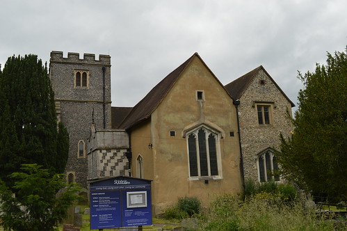
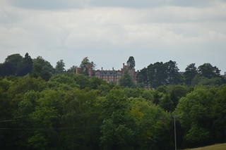
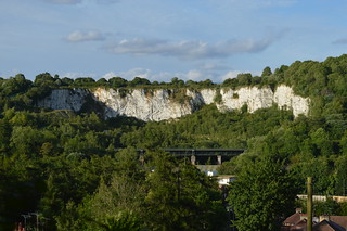
Part 2 of this walk finds me refreshed, resupplied and ready to go in Hamsey Green. Heading out of the village (oh look, nudging back into Surrey again), I enter the rather cumbersomely named Sanderstead to Whtyeleafe Countryside Area. The area's split between three owners, two being the adjoining councils (Croydon and Tandridge) and the third being the Whitgift Foundation, a charitable organisation founded by Archbishop John Whitgift in 1596 and today providing care for the elderly, education and advice for carers. The bridleway that cuts through the area and that I'm following has been around since at least the 1570s, when a map of the time named it Broadwaye. Passing yet another dogwalker, the path leads into a small belt of trees (wouldn't you know it, I'm back in London again), within which lies an Ordnance Survey triangulation point; surprisingly the only one that lies on the LOOP. Soon I'm heading down into the spectacularly steep valley below, via Riddlesdown Road; this used to be the main coaching route towards Lewes and Brighton. Crossing a railway line, I reach the bottom, ending up on what's now the main route through the area, the A22. Consulting my guide book, my heart sinks when I see that I am indeed going to be climbing back up the other side of the valley; a third steep ascent of the day. Over the other railway line (one goes to Oxted, the other to Caterham), then up New Barn Lane (exhausting enough in itself) and into the woods again. A flight of stairs helps somewhat, but I'm still gasping when I finally reach an open field at the top (Google Earth tells me the average gradient of this short stretch was 1 in 7!). I've reached Kenley Common, one of four commons in the area grouped together under the Coulsdon Commons banner. Owned by the City of London Corporation, I've already walked across Riddlesdown (guess where Riddlesdown Road is?), and I'll meet the other two later on. Incidentally, the name's a bit of a misnomer, as none of the spaces are registered as commons today.

Kenley Observatory
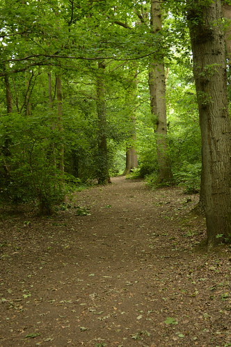
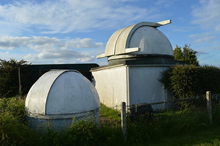
Kenley Common played a crucial role in both World Wars as a fighter plane base; along with RAF Croydon and RAF Biggin Hill, RAF Kenley was instrumental in the Battle of Britain. The airfield is still in use today, owned by the Ministry of Defence and home to 615 Volunteer Gliding Squadron; powered aircraft are currently prohibited from using the airfield. My walk takes me along the northern edge of Kenley Common, then curves southwestwards into an open field with a pair of redundant kissing gates at either end of the path. I take the opportunity to sneak a quick look at the airfield itself, then proceed up a sleepy lane and along a short stretch of pavement-less main road before diving back into the trees. Out into a field, then across a road into another field, past the Wattenden Arms pub (reputedly a favoured haunt of the airmen stationed at RAF Kenley). On the way out of this latest field, I pass a strange squat structure with a domed roof, and am quite surprised to find it's an observatory! Kenley Observatory is owned by the Croydon Astronomical Society,which celebrated its 60th anniversary last year. Construction started in 1967, and the observatory was officially opened in 1979. Unsurprisingly the observatory was closed when I went past in broad daylight, but come visit on a Saturday evening and you can take a look through their telescope. The North Downs asserts itself again as I descend down Waterhouse Lane then immediately ascend up Rydon's Lane to reach Coulsdon Common, passing the site of a former windmill on the way.

Water fountain on Coulsdon Common
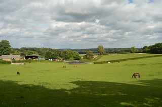
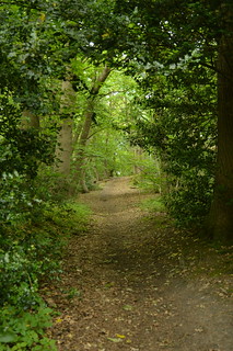
Coulsdon Common was named for the medieval manor it lay in, but unlike most of the other commons I've passed through today it was not used for agriculture, as the soil here was of too poor quality. The land was thus given over to the grazing of sheep and cattle, creating the open landscape that enabled two windmills to be erected here in the 18th century; the later of the two survived until 1924 when it was demolished. One 18th century building that's survived is The Fox pub, which was opened in 1720 and continues to quench thirsts to this day. I pass by and continue into the third of Coulsdon's Commons, Happy Valley. This area was purchased under the Green Belt Scheme of 1937, being described as "one of the most beautiful valleys in the whole neighbourhood". One of the principal reasons for its purchase was to link Coulsdon Common with Farthing Downs; after all, a belt's not much good if it doesn't join up! Initially I'm led along a broad tree-lined path, past a series of trim trail stations (I declined to make use, I though I'd done quite enough exercise already!). This path curves northwards, and brings me out to a magnificent viewpoint over the valley. Thankfully this one's not as steep as earlier, and my descent and ascent up the other side is markedly more gentle, something I'm rather grateful for at this late stage of the walk! I press on, passing a group of ramblers going in the opposite direction; rather late to be setting out into the valley I thought. I soon enter my last wood of the day, Devil's Den Wood. The name's origin is unknown; suggestions have included a pit called Devil's Den or folk legends of devil worship in the area. The wood is quite open, and I enjoy the light of the setting sun playing through the leaves as the path slopes upwards to bring me to Farthing Downs.

Farthing Downs
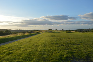
Farthing Downs is an area with some serious history behind it; archaeological evidence dates some of the earliest activity to the Neolithic Era, over 6000 years ago. Eventually a patchwork of fields dominated the landscape throughout the Iron Age, from around 700 BC into the 2nd century AD. The remnants of this farming system can be seen in some of the earth banks and ditches still visible today. By Saxon times, the land had been given over to barrows and burial mounds which, given the altitude of the Downs, would have been seen from miles round. In medieval times the land was used for the grazing of sheep and cattle, and this use continued through to the 19th century. In 1883 the City of London Corporation bought the land from Edmund Byron, but the use stayed the same until the Second World War, when Farthing Downs was requisitioned for military use. Anti-glider ditches were constructed across the landscape, and the space suffered many hits from enemy bombs and fallen aircraft. Thankfully these days rather more remains of the ancient activity than wartime damage, and the walk across this magnificent stretch of grassland is a fine way to near the end of this walk. Spotting the skyscraper cluster of Central London on the horizon for the 3rd time, I pause for a few moments to drink in the beauty of the place, illuminated by the fiery light of the setting sun, before setting off on the home strait, down some rather less pretty residential streets and up an alleyway to reach Coulsdon South station. I sink onto a bench, glad to rest my weary feet (15.2 miles up and down and up and down will tire you out!), and wait for the train to whisk me back home...

(except that didn't go quite to plan because Thameslink cancelled the train I was waiting for, so I had to get a bus to Croydon before I could catch any trains!)

Thursday 30 November 2017

London LOOP: West Wickham to Coulsdon South Part 1

St John's Church, West WickhamMonday 12th June finds me at the bottom of West Wickham Common, ready to set off on section 3 of my London LOOP walk. This one is marked to take me through Addington, Whyteleafe & Hamsey Green on the way to Coulsdon. It's not the best start to a walk I have to admit, immediately directed off down an alleyway that soon brings me out to a residential street. However, it's not long before the first greenery of the day appears, in the shape of Coney Hall Recreation Ground. It's here that I stumble across an unexpected early highlight; a small stone obelisk marking the passage of the Greenwich Meridian through the park. I pause for a moment, doing what tourists from around the world queue to photograph 7 and a half miles north, then continue past a nursery and across a road into the entrance of Wickham Court School; Wickham Court itself was the ancestral home of the Boleyn family, and was where Henry VIII proposed to Anne Boleyn, mother of Elizabeth I. My route takes me past the entrance gate and into the churchyard of St John's (who have their own blog). A tantalising view through the trees tempts me to the western edge of the churchyard, but alas, there's not much to see, and the presence of a pair of curious workmen nearby prompts my departure.

Route through Cheyne WoodThe walk takes me down a hill into a field of horses, a few of which break off from their grass-munching to eye me suspiciously as I pass by. Crossing a busy road at the bottom of the field takes me into Sparrows Den, a location that holds some treasured memories for me as the location of a pitch and putt course my late grandad took me and my brother to whenever we stayed with him. I cut diagonally across several rugby pitches (owned by Old Beccehamians R.F.C.) to reach a wood, which marks my entrance into Spring Park, a City of London owned common since 1926 (although not actually registered as a common today). The path cuts upwards then banks left, to take me along the southern edge of Cheyne Wood. An information board along the way relates the story of the superb Ancient Order of Froth Blowers, a charitable organisation that helped fund a children's heart hospital in the area. The LOOP continues through the trees for some distance, crossing stream beds and at one point, the boundary between the boroughs of Bromley and Croydon, which also marks the transition into Threehalfpenny Wood. Eventually the path leads out onto an area of open grassland, Shirley Heath, where an unexpected vista to the north reveals the skyscrapers of the City and Canary Wharf in the distance. It's not the last time I'll spot them on this walk.

Crystal Palace Transmitter from Shirley Church Recreation RoadThe route dives back into trees, taking me through Kennel Wood past groups of homebound schoolchildren, before emerging onto Shirley Church Road. I follow this road for just over half a mile, passing Shirley Road Recreation Ground (the open nature of which reveals the Crystal Palace Transmitter in the distance), before turning left past Shirley High School and up a tarmacked path to Sandpits Road. It's at the end of this road that a limitation of the LOOP asserts itself; being effectively a linked-up collection of paths, when it comes to having to cross busy roads there's not much option other than waiting for a brief gap in the traffic and dashing across. Luckily I don't have to wait too long, and am soon on the move again, heading towards Addington Hills. Having been to the viewpoint before, I was prepared for a somewhat steep climb, but still found myself heavily out of breath after a brutally vertiginous ascent. The view makes it all worth it however, with a wide panorama stretching out before me; from Croydon in the west, round past the twin transmitters and the City, to Canary Wharf and Lewisham in the east. I rest for a few minutes, having a bite to eat, before deciding it's time to carry on.


View over Addington from Bramley BankLeaving the viewpoint, I head southwards, past a signpost that tells me I'm now 21 1/2 miles from Erith, and 25 1/4 miles from Kingston Bridge. Passing a rather ominous pentagram drawn in the earth, I'm led southwest down a dip filled with fragrant pine trees, with the path becoming darker as the trees close in on the way out. Passing Coombe Lane tram stop on the right, I follow the tram tracks for a short while, before turning off to enter another small grove of trees, which slope downwards and bring me to the manor house of Heathfield. A former farm turned Georgian manor estate, replete with ornamental gardens and stable, nowadays the house is used as an ambiguously named "training centre", while the grounds are the base for the Croydon Ecology Centre. Skirting round a pond, I head up some steps and back out to a road, then stride downhill past a man performing some classic car maintenance, before plunging into the latest area of woodland, this being Bramley Bank. The woodland is managed by the London Wildlife Trust, and apparently contains the largest woodland pond in Croydon! Another view across the fields presents itself, before I have to negotiate a tricky section overgrown with stinging nettles. Luckily I escape unscathed, and continue down through the trees.

Path through Foxearth WoodIt won't surprise you to hear that almost immediately upon emerging from Bramley Bank I'm back into another wood, this one Littleheath Woods. The woods were bought by a combination of Croydon Council, Coulsdon & Purley Council and publicly raised money to save them from housing development, and they were dedicated as a public space in 1932. The LOOP cuts into Fallen Oak Field, where a lone man on a bench watches my progress along the bottom of the field, then diverts south into Foxearth Wood. I'm joined at this point by the Vanguard Way, another long-distance route that runs from Croydon down to Newhaven in East Sussex; I'll be paralleling this walk for the next couple of miles. I get a bit confused further on and end up taking the wrong path at a junction by a water tower, emerging from the woods much too early and in completely the wrong place. Retracing my steps I manage to take the right path at the second time of asking, and proceed down an increasingly narrow tongue of woodland to Addington Road (more precisely the boundary between the wards of Selsdon and Addington). Crossing the road I'm led up a bridleway that strikes out between backs of houses towards Selsdon Wood. It's here that I encounter my second steep ascent of the day, and by the time I reach the entrance to Selsdon Wood I'm panting heavily. Foolishly I don't have much water with me, so I make do with what I have as I rest for a moment, before continuing up into the wood.

De Vere Selsdon EstateSelsdon Wood is officially Ancient Woodland, but small parts were used for farming in medieval times. In the early 20th century the land was broken up and started to be sold off. Local groups were concerned about the rate of development of the formerly rural Selsdon, and rallied together to purchase a 200-acre area, which was passed to the National Trust, and opened to the public in 1936. The LOOP is signposted up a hill that slopes northeastwards, through oaks and beech. Eventually the gradient levels out somewhat, meaning I can stop feeling like my lungs are about to fall out. The reason for all the hilliness is the North Downs, the chalk ridge that runs through Surrey and Kent and the foothills of which I'm now entering. Passing a lone dogwalker, I come to a narrow track, Baker Boy Lane. It may not look much, this path between wood and field, but the boundary between London and not-London runs parallel a couple of metres to the west; indeed by walking down this path I'm now marginally in Surrey. The field is soon replaced by Puplet Wood on my left, but it's not long before both woods are left behind, as the lane emerges close to the entrance to Farleigh Golf Club. I'm then directed down the side of Elm Farm, leaving the Vanguard Way behind, as I meander downwards through Mossy Hill Shaw. A grand house sits on the horizon to the north; later research reveals it to be the De Vere Selsdon Estate, seat of the Bishop of Rochester for much of the 19th century, but converted to a luxury hotel in 1925. Emerging in a field filled with waist-high wheat stalks (now back in London again), I soon come to a tarmacked road, which becomes increasingly residential, signalling my arrival at Hamsey Green and the end of part 1 of this walk. Part 2 takes in two valleys, an airfield and an unexpected astronomical feature...

Thursday 16 November 2017

A Ridiculous Project

Do you know how many stations are in Greater London? That's Underground, Overground, DLR, Tramlink, TfL Rail, National Rail and Cable Car stops (basically, anything on the London's Rail & Tube Services map).

A couple of weeks ago, the seeds of an idea formed in my head. Had anyone, I wondered, been mad enough to visit every station in Greater London? Probably, I reasoned; that's not particularly crazy. However, I'll bet no-one's done it... alphabetically.

So back to the original question. Turns out there's 598 of them, from Abbey Road to Worcester Park. And I'm going to visit them all. When I say visit, I mean visit; I'm actually going to get off the train/tram/cable car and leave the station, to see what's around, what sort of environment the station sits in. You never know, I may even write about it.

As you may have guessed by now, this will not be a quick project. However, I'd like to get it done by the end of next year, 2018 (which is very optimistic I know!). I'll be documenting my progress on here and on Twitter (what do you mean you didn't know I have a Twitter account?), so you can follow my gradual breakdown in excruciating detail.

I'm hesitant to put a start date as I rarely seem to be able to stick to them, but provisionally this is going to kick off on Friday 17th November. See you at Abbey Road...

Monday 6 November 2017

I'm back... maybe

Hi.

I've not released anything for ages on here, which is due to a combination of factors; mainly the fact that I'm trying to write a mega long summary of a journey I took back in the first half of the year, but keep getting stuck where I'm not sure how to articulate what I want to say. I also went on holiday for 3 weeks (to Canada since you ask), and have actually moved house. Indeed, the name of this blog is now a slight sham, as I now live in southwest London. Work is always there as well, and there will always be the underlying theme that I'm really quite lazy.

However, I want to change that. I've got a couple more London LOOP walks to write up, a holiday to talk about, and I'm launching a ridiculous project possibly next week involving the alphabet and a lot of travelling. Stick around and this time I might give you more than a post a month to read...

Thursday 22 June 2017

London LOOP: Petts Wood to West Wickham Common

Petts Wood coat of armsIt's the 12th April, and I'm standing at Petts Wood station, ready to set off on my second section of the London LOOP, from Petts Wood to West Wickham Common. This section is section 3 of TfL's designated division of the walk, and is supposed to be around 9 miles long. Before I start, I have a confession to make: this is actually not the first time I've tried this walk. Around a week and a half previous, I made the (quite literally) ill-fated decision to try this the day after suffering from a hideous cold-like ailment. Unsurprisingly I didn't make it particularly far before deciding it was best for me and the walk to give up and leave it for another day. A shame, seeing as the weather on that day was gloriously sunny, whereas today's walk starts under dull grey clouds. I nip into a nearby Morrisons to grab some provisions (not doing this being another mistake I made first time round), then head off up Queensway, passing the crest of Petts Wood (no I didn't know they had one either). Technically the LOOP actually restarts at the eastern entrance to the Jubilee Country Park, reached via the delightfully named Tent Peg Lane, upon which I'm assaulted by a rather unfriendly dog. Luckily I emerge from the encounter unscathed, and pass into the park to properly start section 3 of the London LOOP.

The Kyd BrookJubilee Country Park was bought by Bromley Council in 1977 to celebrate, as the name suggests, Queen Elizabeth II's Silver Jubilee, and was opened to the public as a park in 1981. My route took me along the southern edge of the park, with a wide vista of grassland and trees to the north. Several butterflies weaved between the trees as the path curved southward, running alongside a primary school for the last bit before bringing me to the rather less tranquil Southborough Road (receiving attention from another excitable, although less aggressive dog along the way). A trudge down some rather unexciting suburban streets follows, but at the end of Faringdon Avenue the path leads into Crofton Woods, home to a section of the Kyd Brook, tributary to the River Ravensbourne via the River Quaggy. Through the trees the path wound, showing recent evidence of horse riding and cycling in its rather uneven state. Passing out of the wood takes me alongside one of the branches of the aforementioned Kyd Brook until I'm brought out to the A232 (Crofton Road). A rather uninspiring section follows, down a narrow alleyway then along more residential streets, but soon I'm directed off into Darrick Wood, which slopes uphill, then bends left along some playing fields, before bringing me out to a rather magnificent view, over the London/Kent border. I head down the field, past a playground and onto a path that leads to a busy main road (the A21), which I scamper across through a gap in the traffic. Past some garages and up a Prime Ministerially-themed set of residential streets, to emerge in the village of Farnborough.

Farnborough High StreetFarnborough (derived from Fearnbiorginga, meaning "village among the ferns on the hill") has existed since 862 AD, when records show Ethelbert gave away 950 acres at Farnborough. By the 13th century a manor existed here held by Simon de Montfort. The village grew up on the road from London to Hastings, and became a coaching stop in the 1600s. Being a coaching stop means a fair few pubs have existed and do exist in the village, including the Change of Horses; on one day during the 1970s the pub went through 3 names in a day, opening as the New Inn, changing to the Golden Nuggett (to suit the theme of that year's St Giles Fair), then renaming to its current name in the evening! Trying to leave Farnborough I misread my directions and the map, and erroneously headed west back towards the A2. I didn't mind as it meant I passed a few more local landmarks, including The Woodman pub; upon taking a picture the landlord appeared from inside and asked why I was taking said picture (rest assured nothing unfriendly, in fact the complete opposite). After carrying on in the wrong direction for another couple of minutes, I finally gave up and got my phone out, and got myself back on track. My route out of Farnborough took me past St Giles the Abbot Church, where a wedding party was assembling, then through the graveyard and into an expansive field. I kept left, hugging the edge of the woods before plunging into them as the hill continued to take me downwards. I soon reached a country lane, and crossed over to enter High Elms Country Park.

High Elms Country Park  High Elms Country Park started life as a farmhouse belonging to the Brazier family; the Lubbock family bought the estate in 1808. A manor house was built in 1842 by John Lubbock III, but its most famous resident is probably his son, John Lubbock IV, a scientist and social reformer who became Baron Avebury in 1900. The estate was sold to Orpington District Council in 1930, and subsequently used as a training centre for nurses from King's College Hospital. In 1967 the estate passed to the London Borough of Bromley, who designated it protected Green Belt space. I investigate the Green Roof Cafe as a potential place for lunch, but decide against it. Instead I climb a short hill, passing the Eton Fives Court, the best preserved remainder of the estate. After pausing for a bite to eat, I continue up the hill to come out at the site of the manor house, now a grassy space with indications of where the house used to be. I head out the other side, down a tree lined path, and find myself in a car park. This is the first point on the LOOP where I get slightly lost, with a lack of signposts and the directions in my guide vague. Eventually I find my way out to High Elms Road, where I cross over to a narrow footpath just off the road. Passing High Elms Farm on the left (I'll give you one guess as to why it's nicknamed 'Clockhouse'), I turn right and head away from the road, past a golf course and into some woods, which bring me down to North End Lane, opposite North End Farm and a bus stop; despite only having 12 services a day, I was (un)lucky enough to arrive at the same time as an R8 tried to squeeze its way down this narrow, unpavemented lane. Fortunately I managed to avoid being squashed, and continued down one of the more amusingly named roads of this walk.

The Wilberforce Oak The LOOP takes me round the edge of some more fields, before dumping me on Farthing Lane, which twists and turns past horses and pylons to feed into Shire Lane; for the first time in a while I have to wait cross the road into, yep you guessed it, another field. The LOOP stays close to the road here, but I'm looking the other way, towards a distant house on the horizon. Further investigation when I get home reveals it to be Holwood House, former residence of 19th century Prime Minister William Pitt the Younger and site of an important decision (more on that in a moment). I follow the edge of the field, which skirts round Holwood Farm, and begin my ascent of what turns out to be a hideously steep hill. I arrive at the top, sweaty and out of breath, grateful for the appearance of a bench. Pausing here gives me the chance to admire a great view, and to take a look at the Wilberforce Oak; for this is the site of the aforementioned decision. It was here, in 1788, that William Wilberforce resolved to campaign for the abolition of the slave trade after a conversation with Pitt the Younger; it took another 20 years before the Slave Trade Act was passed into law. I rest here for a few minutes, the occasional plane buzzing overhead (Biggin Hill Airport lies less than a mile and a half to the south), before deciding it was time to press on.

Keston PondThe LOOP carries on through the woods, now descending gently in contrast with the steep rise earlier, eventually coming to the A223 Westerham Road, where I cross over and enter Keston Common. This area was initially inhabited by Iron Age settlers in around 200 BC, who constructed earthworks to help with the threat of invasion. These earthworks are still visible today, although eroding badly. The path takes me across the earthworks and through a car park, then down to a small pool of water. This doesn't look much, but it's reputed that Julius Caesar set up a camp here after being led to the spring by a raven; this then explains the name of the river that has its source here: the River Ravensbourne. The fledgling river runs down a brick lined culvert into Keston Ponds, a favourite spot for anglers and walkers alike, and one of the prettiest points of this walk. The LOOP cuts between the two ponds, then takes back into more woods, before bringing me out by another primary school onto Lakes Road, which in turn leads to Keston Village Green, a spot I recognise from a visit some years previously.

View southwest from West Wickham earthworksI'm on the home strait now, as the route pretty much parallels a tree lined road. I'm hemmed in by houses and fences on my left, although occasionally these drop away to reveal a view to the southwest, towards (though I don't know it at the time) the vague location of my next LOOP walk. However, this walk has one last surprise in store before the end, which is another set of Iron Age earthworks. These later became part of a medieval field system, then possibly an artificial rabbit warren in the 17th century. The view southwest opens up again one last time, before I head quite steeply downhill, past a tree planted for West Wickham's centenary celebration, ending up on the busy A232. Typically the nearest bus stop is rather infrequently served, and so my walk is slightly prolonged as I carry on to a stop that has better services. A few minutes wait gave me the chance to catch my breath and rest my legs from what had been a long, but undoubtedly pleasant walk. As the bus arrived to whisk me back to Bromley, I already had half an eye on the next one...

A selection of photos here:
 London LOOP 2

Friday 12 May 2017

Core Journey

We start on the bridge. 4th carriage, 1st set of doors, positioned just to the right in the nook between the doors and the luggage rack. The doors rumble as they slide shut, then we're off, down the slope and almost immediately into the next station. White tiles, hints of previous ownerships dotted along the platform. Doors open, doors close, the number of people on the train stays the same. Uphill start this time, then a curve to the left as we emerge into the 3rd station, old brickwork transitioning into brand new stark white tiles. Adverts for jewellers, warnings about fare evasion. More significant interchange here, the Underground both attracting and expelling passengers. We sit here for a couple of minutes, unnecessary time built into an inflated timetable, but finally the doors shut for a third time and we're moving again. We pass under the Underground, then through successive tunnels, daylight illuminating the carriage for brief moments. After the third stretch of darkness, we rumble into the past. "DO NOT ALIGHT HERE", years old adverts, disused platforms littered with the detritus of abandonment. Some passengers take this as their cue to ready themselves, as we curve left, then right, screeching into the present, and the future. We stop opposite the escalators, the doors open and I'm off, marching away to make a tight connection.

The Thameslink Core. 30 years in the making.

Sunday 7 May 2017

The Rail Replacement Bus

It's Sunday. I have to go to work. Normally this would be simple; turn up at the station, get on a train, arrive at destination.

But not today. Today engineering work closed a section of line, including my station, and so I had to get up half an hour earlier to then catch a bus that dropped me off at a station not quite in the middle of nowhere, but not far off. So much time had been allotted for our journey to the station that we ended up waiting another 20 minutes for the onward train to London. Luckily, given this journey took place at 7am on a Sunday morning traffic was not an issue, and neither was the amount of passengers.

And yet I don't mind rail replacement buses. I certainly don't have the level of vitriol some people reserve for them. Perhaps it's because I don't have to take them regularly, perhaps it's because I like taking buses in general, perhaps it's because it's a little bit of a break from the norm; whatever it is, I don't descend into frothing rage whenever I see my journey will be made partly by bus rather than train. Call me mad, call me odd, call me maybe (no wait don't do that); I like public transport too much to be angry at a bus.

Friday 14 April 2017

London LOOP: Erith to Petts Wood Part 2

I'm undertaking a project to walk the entirety of the London LOOP, from Erith to Purfleet clockwise round the outer edge of London. Here's section 1, part 2.

Electricity overheadTfL's Section 2 of the LOOP has me heading down a narrow lane, passing under the railway line and emerging alongside some fields. The path bends to the right, coming up alongside Bexley Cricket Club & Burnt Ash Hockey Club, before climbing for a short distance to leave me looking out across a wide expanse of grassland. The LOOP runs straight through the middle, down a rough descent then along a freshly ploughed field, before leading into a cul-de-sac. I'm only on Riverside Road for about 50 metres before I'm directed down a narrow fenced path, which empties me out onto a bridge over, you guessed it, our old friend the River Cray. I wend my way beside the river, with the path at times becoming uncomfortably close to being in the river itself. Soon I pass Five Arches Bridge, where a group of youths clamour for me to take their picture, having been just starting to cross the bridge when I photographed it. Thankfully they're not going the same way as me, and I carry on in peace towards what will be my last crossing of the River Cray, over Penny Farthing Bridge. I come to a small open space amongst the trees and leave the Cray behind for good this time; its accompanied me on the nicest sections of this walk so far.

My route takes me onto Rectory Road, past a youth & community centre who were definitely trying to tell me something, and on to a crossroads. Straight over, then second right to the end of a cul-de-sac, where I then turned left down a narrow path that led me into Foots Cray Recreation Ground. By this point it was half past 5 and starting to get dark, and I was beginning to wonder just how dark it was going to be when I got to Petts Wood. I pressed on, up a rising path past allotments and fields, passing also (although I didn't realise at the time) the former home of Cray Wanderers FC. Soon I reached the bottom of Sidcup Place Park, which climbed steeply towards a line of trees and behind them, Sidcup Place itself. I pass through the trees and round a playground, then curse my stupidity when I turn around and glimpse a fine view, now obscured by the trees. Whilst not completely exhausted, I'm in no mood to go back down that hill, and so I turn my back and head on.

Scadbury Nature ReserveSidcup Place was built in the 1750s and extended throughout the 19th and early 20th century. Today it houses a restaurant, but has been used as a school and as council offices in the past. I pass by the side of the building, drawing a strangely interested look from a family by a window, and walk over the grass to the main road, the A222. Passing Queen Mary's Hospital on the left, I'm coming up to a bit of road I'm very familiar with; Frognal Corner, the junction of the A20 with the A222. I pass under the junction via stairs, ramps and subways, and emerge on the London-bound exit slip road of the A20, where I'm directed through a metal gate into the northeastern fringe of Scadbury Nature Reserve. The path starts to slope downwards as I'm taken southwards through the woods, with the light fading. I pass a lone dog walker as the route curves to the right, heading towards Scadbury Manor House, and soon I'm standing by the moat that surrounds the house. Owned by the Walsinghams in the Middle Ages, the original structure was demolished in the 1800s, and partially reconstructed in the 1930s using the ground plan as a guide. All that remains today are some brick pillars and chimneys, and a staircase.

The light by this point is fading badly, and I hurry onwards, my thoughts now more about just getting to the endpoint before darkness falls completely. The path starts to slope uphill again, and it's not long before I meet a tarmacked road, which leads me out to St Paul's Cray Road. Eventually a gap in the traffic lets me scamper across, and I pass into Petts Wood. The doleful hooting of an owl serenades me as I walk briskly through the gloomy trees, heading steadily downhill again. By the time I reach the railway line at the bottom of the hill darkness has fully descended, and I'm now finding it difficult to see where I'm going. I'm startled by another dog walker, who's going the opposite way (into the woods in the dark?) before coming to a footbridge over the railway line (the Chatham Main Line). I quickly come to another footbridge over a railway line, this one crossing the Up Chatham Loop between the Chatham Main Line and the South Eastern Main Line. A narrow footpath brings me out into the cul-de-sac of Little Thrift, where the very last part of this walk is unwalkable, as Network Rail have removed the footbridge carrying the LOOP over more railway lines. The last mile or so then is a trudge through suburbia, before reaching Petts Wood railway station, 6 hours and 47 minutes after I left Erith.

I slump on a bench on platform 3 at Petts Wood, happy to rest my weary legs. In truth, my misjudgement of the time it would take me to complete this walk meant the last 2-3 miles were not as enjoyable as the rest of the walk, but nevertheless, it was a fine start to this project. When I got home and plotted my route in Google Earth, I found one reason for the misjudgement; the planned mileage had been 15 miles, but I'd ended up walking 17.2! No wonder then that I'd finished almost an hour later than anticipated. Still, the walk had been very enjoyable, and had left me excited for what lay ahead.

More photos from this walk here:
 
London LOOP 1

Thursday 13 April 2017

London LOOP: Erith to Petts Wood Part 1

I'm undertaking a project to walk the entirety of the London LOOP, from Erith to Purfleet clockwise round the outer edge of London. Here's section 1.

The Beginning!Huzzah! It's 12:18 on the 18th March, and I'm finally standing outside Erith station, ready to start the first section of the London LOOP (London Outer Orbital Path, making it somewhat of a tautology like ATM machine or PIN number). The LOOP doesn't actually start at Erith station, so there's a brief walk through a new build housing estate, heavy with the smell of fresh tarmac, before I reach Erith Riverside Gardens and the start proper of the London Outer Orbital Path. The gardens themselves are unspectacular, standard brick flowerbeds and a ship's mast now used as a flagpole, but as the origin of one of London's longest walking routes it's pretty significant. You would think, being called the Riverside Gardens that there would be a river nearby, and you would think right; midway along the riverfront there is a step to some stairs going down to the Thames Path, which gives a nice panorama of the river at this point. I snapped a few photos, then set off properly on the London LOOP.

Back up Erith PierThe Thames Path is rather relevant at this point, as it shadows the London LOOP for some distance. This meant the first section of this walk was sort of familiar, as I'd walked the Thames Path a couple of years ago. Exiting the Riverside Gardens I passed the first of many information boards about the LOOP, this one detailing some of the history of Erith (for instance King Henry VIII's warship Great Harry was fitted out in Erith). Heading up Erith High Street I passed the old police station (still with a weathered-looking sign asserting it was no longer a police station), then the Cross Keys pub, turning left down a path just before the Erith Playhouse. This path led me back out to the Thames, where a pier stretched out into the murky water. Opened in 1845, it's a legacy from the days when Erith attempted to become a fashionable Victorian seaside resort; unfortunately the railway arrived in 1849, considerably cutting journey times to London, and the opening of the Crossness Sewage Works upriver in 1865 hastened the demise of the town as a leisure destination. The pier was sold to a coal merchants in the late 19th century, and was rebuilt in concrete in the 1950s before being abandoned, then rescued by Morrison's supermarket in the late 1990s. Nowadays it's a popular spot for fishing, or to sit and watch the river go by.

Path across Crayford MarshesAfter nipping into the aforementioned Morrison's, the LOOP took me back out to the river for a short stretch, before making a lengthy detour along Manor Road, lined with various industrial units. I suspected this would be the least scenic part of the route, and was relieved when I saw the signpost directing me left down a path back towards the river. The path curved to the right, then led me out onto the top of a raised bank, looking out across Crayford Marshes, with the river to my right and the QE2 Bridge in the distance ahead. The path wound across the grassland, curving gently with the riverbank. Unfortunately the natural beauty is blighted by an industrial estate, of which the path follows the northern edge. As you round Crayford Ness a large, rather brutal concrete structure reveals itself; this is the cumbersomely named Dartford Creek Tidal Flood Barrier, which stops the River Darent from inundating a large swathe of southeast London/northwest Kent. Talking of the Darent, this is where I take my leave of the Thames (I won't see it again until Kingston), and follow the Darent for a bit. The landscape doesn't change much, except I'm now heading roughly south. The Darent is not a particularly pretty river, but it's not long before I reach the junction with the river Cray, which will now feature quite heavily over the next few miles.

The River Cray at CrayfordThe Cray at this point is mostly invisible under an abundance of reeds, but this stretch only lasts about 1/2 a mile before I'm diverted off onto a path that runs through the southern tip of another industrial estate. A swarm of seagulls swoop over a landfill site, and a pair of angry dogs warn me off trespassing (not that I was about to). Under a railway bridge, and suddenly I'm on a busy main road, the A206 to be precise. I cross the road, head past a roundabout and cross again, then carry on down a short distance to the entrance to the next part of what I discover is now the Cray Riverway. From this point the Cray is much more pleasant, wending its way between the backs of houses and yet another industrial estate, but screened from the latter by trees and bushes. A few pylons stalked the opposite bank as the river and I wound our way towards Crayford (the origin of the name should be fairly obvious). The riverside path ends up on Crayford Way, opposite the Cray Gardens, just to the north of the town centre. Having taken advantage of a handy convenience, I walked through the gardens, which contained several artworks commemorating people and past industries of Crayford, such as David Evans (the silk manufacturer) and the old Vickers plane factory. The Cray runs through these gardens, but I won't see it again for just over half a mile.

River Cray at Hall Place ParkThe LOOP takes me up London Road (how many London Roads are there in London?) past some residential blocks and an entrance to the estate where the aforementioned David Evans silk factory used to stand (closed in 2001), then left into Bourne Road, where a former theatre turned cinema turned car showroom still has some ornate lamp columns flanking its forecourt. Immediately afterwards I'm directed into a large park, where several amateur football games were taking place. It's here I rejoin the Cray as it divides this park in two. The path takes me past a bridge that I very soon have to return to, as the bridge I'm supposed to go over is blocked off by utility works, as is the entire path down to the southern edge of the park. (My preoccupation with this meant I missed one of the landmarks of the walk, Hall Place). I end up scrambling down and up the sides of a ditch, and find myself alongside a railway line (it's the Sidcup line). A short walk on, past a couple who clearly thought this part of the park would be unsullied by other human presence, and up a flight of stairs, which dumps me out straight onto the busy A2; quite the contrast to the last mile or so.

Luckily I'm only on the road for a few moments, before I take a gently sloping path down to... yet more utility works. These however appear to have actually blocked my way forward, as I'm supposed to turn sharp left after the initial downward path. After yomping through some undergrowth in an attempt to find a way through, I'm left cursing the utility company; that is until I spot the path I want when I return to the original way. Feeling suitably foolish, I pass under the A2 alongside the railway line again, and mount a stile to get into Church Field Wood, which slopes uphill towards Bexley. Out of the woods and onto a path which brings me out opposite St Mary the Virgin Church, which has stood in Bexley for over 800 years. I cross the Cray again as the path takes me into Bexley town centre, which is where section 1 of the official TfL LOOP ends. I however am carrying on...

Wednesday 5 April 2017

A moan about an advert...

It's time for my first moany blog, or mlog if you like that sort of thing (I don't, that sounds stupid). I see this advert on the train into work quite often:


Villa Plus advert

There are several things that irritate me about this picture:
  1. Why is the man on the left so shocked?
  2. Where is the woman at the table aiming?
  3. Why are they still playing when the people playing yellow have clearly won?
  4. Why is the man on the right shouting?
  5. Why isn't the woman at the table even pointing her cue at the cue ball?
I know it's a staged photo but really, put some effort into it please!

P.S. I'm still writing about my not-very-recent-any-more train journey and my first London LOOP walk, they will get done soon I promise!

Tuesday 14 March 2017

Alphabetical Kent: Boughton Street/Boughton/Boughton-under-Blean

As part of a project to get to know my home county a bit better, I'm visiting one randomly chosen place (that I've never been to before) beginning with each letter. Here's B.

Boughton Street, or Boughton-under-Blean, or just Boughton is a village around 2.75 miles east of Faversham. At the 2011 census, it had a population of 1,971 people, which is quite a bit more than the first place I visited in this series, making me hopeful that it would be slightly more interesting than Acrise. Getting there was a little easier; a train to Faversham then a bus that took me straight to Boughton. The bus deposited me on Bull Lane, a road that runs north out of the village alongside some fields. The initial view northwest from here was really rather good, especially in the afternoon sunlight; much better weather than last time. I headed down the hill into the main heart of Boughton.

Westwards along The Street, BoughtonThe village is a classic design seen all over Britain; one main street running through the middle with houses strung out along the road. Houses at the western end of the village range from timbered Tudor constructions to rather more modern affairs. The first building of note I encountered was the first of two pubs in the village, The White Horse. The pub is an ancient coaching inn, and was mentioned in Geoffrey Chaucer's seminal work The Canterbury Tales (as indeed was the village in general). According to its website, "beautiful landscaping has turned a pleasant pub garden in to an Englishman’s dream." Whether that claim is true I don't know, as the pub didn't look particularly open when I passed by (although another glance at the website reveals it was open, damn). I carried on, and found myself outside a tall church-esque structure, which upon closer examination I found was a Wesleyan Chapel (was being very much the operative word here; this looked definitely closed). The path down the side looked privately residential, but there was what looked like a car park at the bottom, so I ventured down for a look at the back, which almost turned out quite badly; a dog appeared from a hidden entrance and made a beeline for me, sniffing me inquisitively before whining at me. I sensed perhaps it was wise to make my exit from the back of the church, a feeling exacerbated when the dog followed me back up the path. As I carried on up the road, I noticed the owner of said dog come out of their residence. Fearing a confrontation of some kind, I kept going with my headphones in, wandering innocuously up the road towards a public convenience. The owner passed me as I turned away from the main road, but said nothing, and I made it to the toilet unscathed.

Hills above BoughtonThere was no sign of dog or owner when I emerged and restarted eastwards. Next along the road was the village's second pub, The Queen's Head. Not quite as old as The White Horse, it's nevertheless still over 400 years old, and also boasts of their private beer garden, which is maintained by their own gardener apparently. A little further on stands St. Barnabas' Church, with the village war memorial outside. The main road at this point is sunken a few feet below the pavement level, a result of regulations brought in during the "turnpike mania" of the mid-18th century. Past this point the village becomes much more residential, even along the main road, and the only businesses from here to the end of the village are a garage/petrol station and The Dairy restaurant. I paused at the junction of Staplestreet Road and The Street, admiring another view northwest which had opened up, and also the view to the northeast, where thickly wooded slopes rose up above the houses. I turned around and headed back into the village.

Boughton BypassI only really had a couple more things to explore, and the first of these was the village hall, which is situated on the south end of the village recreation ground. I took the long way round, via where the bus had dropped me off (and would pick me up later), and walked along The Charltons, another residential street. The village hall was rather disappointing really; given the architectural vintage of the majority of the village, I was not expecting a bland, squat brick structure with no interesting features whatsoever. The hall also houses the village library. I carried on past the village primary school, and back down to the main road. I paused outside an abandoned hotel, which had been gone for several years by the looks of it. A little bit of digging revealed the hotel had been closed for at least 8 years, as planning permission was given to convert it into apartments at the end of February 2009; I can safely say that didn't come to fruition. With a little bit of time left to kill, I nipped down a footpath that led to a footbridge over the road that means Boughton retains an air of village tranquility: the Boughton Bypass. Before 1976, the A2 ran through the middle of the village, a route as old as the Celts, but it now runs in an arc round the south of the village, diverting all that traffic away; something I'm sure the residents are very grateful for.

Back on the main road, I walked westwards, down towards the western edge of the village and the road crossing of the bypass. Nothing much interesting down that way, apart from Boughton House and a farm. Just after the bridge, a footpath led down into the woods on the south side of the village. I still had some time left, so I plunged into the trees. The path itself was barely there, and aside from a small stream, there wasn't much of merit about the path, which was quite muddy (I almost slipped over at one point) and eventually brought me out alongside the A2. I made my escape via another path which led to the earlier path from the footbridge and came out onto the main road (again). As a last little exploration, I decided to head down the eastern side of the recreation ground and along the northern end, which brought me out opposite the hop fields I'd been dropped off at a couple of hours ago. I made my way back up the road, and waited for the bus to take me back to Faversham.

So, Boughton/Boughton Street/Boughton-under-Blean then. A nice village certainly, but although the place has history behind it, it somehow feels lacking in presenting any of it in an engaging way. Having said that, it was certainly more interesting than Acrise (not that that's difficult!).

P.S. If you'd like to see what the village was like before the A2 got diverted, there's an interesting little video here.

Some more pictures from this trip on Flickr:
 Alphabetical Kent: Boughton Street

Wednesday 1 March 2017

Pinch punch...

In the first post I made, I immediately discounted daily blogging; I didn't however intend to have a 3 week gap in posts. There are several reasons for this:
  1. Work has been keeping me busy
  2. I am lazy
  3. I haven't done any long-form writing for about 3 years
  4. I have a short attention span
  5. Sometimes I'm just not in the right mood for blogging
I'm currently attempting to write up a piece on a rather catastrophic train journey I took recently, but I'm really bad at non-linear writing, so if I get to a point where I can't think what to write, I get stuck and then lose focus quite quickly. Hopefully this blog will help me get better at this sort of thing, but for now bear with me while I get back on track...

Saturday 11 February 2017

Alphabetical Kent: Acrise

As part of a project to get to know my home county a bit better, I'm visiting one randomly chosen place (that I've never been to before) beginning with each letter. Here's A.

Acrise is a hamlet in southeast Kent, about 6 miles north of Folkestone. The civil parish had a population of 172 people according to the 2011 census, which should give you an idea of the size of Acrise. I wasn't particularly enthused by my (or rather Excel's) choice for my first location of this project, especially after a glance at a map showed a church and not much else. However, maps don't tell you everything, and so I set off on a dull, slightly snowy morning to start a 2 hour journey, beginning with a bus to my local station (I could've walked, but I was feeling lazy). From the station it was a train to Canterbury, then a bus ride down to Densole. From here walking was my only option.

Welcome to Acrise
The walk into Acrise took about 25 minutes, down a straight flat country lane at first, lined by low bungalows on one side, and open fields on the other. The snow had picked up slightly by this point, and a fair breeze was blowing it all around, adding to the already chilly conditions. Cars were an infrequent hazard (no pavements here), and a couple of dog walkers were the only people I saw for the next hour. Coming to a crossroads, I was formally welcomed into Acrise, with the sign also proclaiming it to be in the Kent Downs Area of Outstanding Natural Beauty. Here the lane got narrower and more undulating, and I soon found myself descending into a small valley. The fields on either side, with the exception of one small paddock containing a few horses, were strangely devoid of flora or fauna save grass, and it didn't take long to find out why; Ministry of Defence signs proclaimed the area to be used for troop training, and forbade access to the public.MOD Warning Never mind, my destination was just up the other side of the aforementioned valley.

And suddenly I was in the centre of Acrise.The road I was on formed a small triangular junction with another road that led off to the north, towards Swingfield and Denton according to the signpost in the middle. The signpost also told me where the church was located, not that I would've had much trouble finding it, given the lack of much else significant in the vicinity. I therefore squeezed through a narrow gap between a fencepost and a white gate and set off up a muddy path towards the church. The church is dedicated to St. Martin, and is from Norman times, although much of the original architecture has been hidden behind 14th century alterations. It's a small, simple church, and reputedly has remains of a wall painting depicting Saint Martin himself to the side of the chancel arch.

Entrance and tower of St Martin's ChurchI say reputedly because unfortunately the church was locked and gated on my visit, and so the above information has been lifted from the informative Friends of St Martin's Church website. The outer walls of the church were discouragingly lacking in any sort of information, historical or otherwise, and so my initial curiosity about the church was left unsated at the time. I wandered cautiously round the side of the church, taking care to avoid any graves, but the church remained stubbornly obstinate in its absence of any sort of interesting fact, and so I decided to head back out to the road.

The only other building of significance in Acrise is Acrise Place, which borders the church on its western side. Some history about the house can be found here, but suffice to say the site was definitely not open to the common public thankyouverymuch. Apart from that, there was a small trading estate with a large warehouse and some small stone outhouses (and a surprising number of Jaguars parked up), and a couple of farm houses further up the road. Generally speaking however, this was not the most auspicious start to this project, and as I walked back to Densole to catch a bus and start my journey back home, I was already wondering what I'd do if the whole project turned out like this. I guess I'll just have to hope Excel throws me somewhere slightly more interesting for B.

Some more pictures from this trip on Flickr:
Alphabetical Kent: Acrise

Friday 3 February 2017

Projects

Last October, as I mentioned previously, I finished a project to walk the entirety of the London Underground. It was a triumphant moment, but also a sad one; the project had taken nearly 4 years, and now it was over, leaving a void in my life. A void that needed to be filled. So I have not one but two projects in the pipeline, the first of which is partly the inspiration behind me starting this blog.

PROJECT THE FIRST


THE LONDON LOOP


Yes, it's not the most original of projects, but it's another long distance walking challenge, except this time I'm going to try to complete this in less than 4 years. The Transport for London website splits this into 24 stages, but I've condensed it down into 11 because some of the stages are only a few miles long.


Stage Route Stage mileage
1 Erith to Petts Wood 15.5
2 Petts Wood to West Wickham Common 9
3 West Wickham to Coulsdon South 16
4 Couldston South to Kingston Bridge 15.3
5 Kingston Bridge to Hayes & Harlington 12
6 Hayes & Harlington to Moor Park 17
7 Moor Park to Elstree 13.8
8 Elstree to Cockfosters 10
9 Cockfosters to Chingford 13.5
10 Chingford to Harold Wood 14.3
11 Harold Wood to Purfleet 13

I was going to start this last Saturday, but work got in the way, so I'm not sure when I'll be setting off from Erith yet; rest assured it won't be too long. Onto the second project...

PROJECT THE SECOND


ALPHABETICAL KENT


 If you think this is what it sounds like, then you're probably right. I've done some thorough research (read: a quick Google search), and procured a fairly comprehensive list of settlements in Kent. The aim then, is to visit one beginning with each letter of the alphabet that I've never been to before. There are no places beginning with J, X or Z, so that's 23 places in all, randomly selected for each letter. This will probably be a slightly longer term project than the London Loop one, as to maximise public transport options I'm only going to visit places on weekdays, which rather limits the days available.

Having London almost on my doorstep and freely accessible for much of my life has meant I've often neglected my home county in favour of the metropolis; this project's aim is to correct that at least a little bit, and it should be damned enjoyable to boot.

I'm already looking forward to starting both of these projects, and for the first time writing about them as well; I hope you'll enjoy reading about them too.

Sunday 29 January 2017

Walking

I love a good walk.

Ever since I was a child I enjoyed going down to town with my mum every Saturday; a couple of miles or so there and back. When I was around 14 years old I started going for short walks on Sunday mornings; nothing too strenuous, nowhere particularly special, just for the fun of the walk. We'd go on the occasional country walk as a family, again nothing too long, a couple of hours out in rural Kent. But on the 30th June 2011, I stepped off a train at West Brompton*, ready to begin a walk to Woolwich Arsenal*, nearly 16 miles away. It was longer than anything I'd done before; I had no map to guide me, just a vague sense of direction, east along the river. It took me almost 7 hours, and I was exhausted by the end of it. Little did I realise it was the start of something big for me.

Since that first walk, I've recorded over 50 walks of varying distances, from a couple of miles up to over 20. I've walked from A to B, I've done circular walks, but mainly I've walked transport related walks: the Underground (more on that at some point), pre-2015 Overground, DLR and Tramlink, and even a National Rail route. I've walked the Thames from Maidenhead to the estuary, and this year I'm planning to walk the London Loop (this is the project I mentioned in the last post). Overall I have over 700 miles worth of walking logged, around 10 and half days of my life spent pounding the pavements.

Which begs the question: why? To that I say: why not? Walking is the best way to see somewhere as it really is, to explore properly, to experience fleetingly the lives of everyone who lives in a place you're merely passing through. My walks have taken me to locations I never would have gone to in any other circumstance, some fantastic, some not quite so. Everywhere I've visited I'm glad I have, regardless of how good or bad it was, to experience the novelty of a new area, an unexplored neighbourhood, the idea of "I wonder what's round here?".

Work means I no longer have the freedom of days unfilled to pursue this most ancient of pastimes; nevertheless I shall carry on walking whenever I can, and starting now, I'll be sharing it with you as well.

*- These stations chosen because at the time I had free rail travel to both stations as a result of my dad working on the railways, in case you wondered why I chose two such random points!

Friday 27 January 2017

An introduction...

Ah, the awkward second post. Much like trying to write the follow up to the first hit single, it can be difficult to ensure you write something of similarly excellent quality to that stellar opening post.

Except I don't have that problem, because my first post was a load of rambling nonsense really. So whatever I write today doesn't have to be particularly brilliant to be better, which takes some of that crushing pressure off. Good job really, because today's post is intended to be a bit more of an introduction to me, my way of letting you get to know who I am in some small sense, and these sorts of posts are always a bit self-indulgent and therefore a bit crap. Never mind.

So, what to tell you about myself? What to reveal, what to keep a closely guarded secret? Let's start off with my name. No, not my real name; that's going to remain one of those aforementioned secrets. Nope, I'm talking about my blog name, Travelling Man of Kent. This should immediately tell you 3 things about me:
  1. I do some amount of travelling
  2. I am a man
  3. I am from or live in Kent
See, this is going swimmingly, isn't it? But that's all surface information; let's delve a little deeper. Take for instance "Man of Kent" which, if you know your Kentish history, you'll know means I was born east of the River Medway (and if you didn't, well now you do). One could ask what sort of travelling I do, and I'd tell you I like trains, and walking, and any and all London transport (more on all of that at some point). You might even be aware of an obscure card game, which is where the "Travelling Man" comes from (my 1st year of university [another fact about me!{aren't embedded brackets fun}]).

Well I think that's quite enough to be getting on with for now; really, the best way to get to know me is to read this blog (wink wink nudge nudge).

P.S. Starting a project tomorrow, more later (maybe...)

Tuesday 24 January 2017

The First One...

I've done it. I've taken the plunge into the murky world of online blogging. At half past 3 in the morning. Who needs sleep?

I do actually; I've got work in the afternoon, and given the fact I fell asleep on the train home tonight, I would think I need a bit more sleep than what I got last night. Anyway, enough rambling on about sleep. Let's talk blogging. What's this blog about, I hear you wonder? (Who am I talking to, nobody's going to read this). What's this guy got to offer that others don't?

Nothing. Bugger all. Everything I write about will probably have been written about before, by someone else on a much more popular blog; so why bother? I'm bothering because this blog is as much for me as it is for anyone who wants to read my thoughts on travelling, walking, London, music, Kent, commuting, trains, maps, photography, the Underground and anything else I fancy writing about (aha, answered that first question now). I can't even promise you daily posts; in fact, I'm ruling that out from the start. I'm not promising quality, wit, or even particularly interesting content. What I can promise is posts about stuff that I find interesting, and hopefully some of the time at least it'll be interesting to other people as well. There'll be a lot of pictures, quite a few quizzes and even a sprinkling of some good old British moaning from time to time.

Well, I really must get to bed; I don't think I am going to get any more sleep than I did last night...

Ah well.