Wednesday 24 October 2018

Alphabetical London: Alperton - Angel Road

I'm undertaking a project to visit all 598 Underground, Overground, National Rail, DLR, Tram and Cable Car stations in Greater London in alphabetical order. Here's Day 3.

It's a cold morning on the 6th December 2017, and I'm out and on a train to Wimbledon, where I change for the District line to Earl's Court. One more change takes me to the subterranean Piccadilly line platforms, and I'm soon on the way to...

Alperton (ALP)
Station opened: 28th June 1903 (as Perivale Alperton)
Railway opened: 28th June 1903 (by the District Railway)
Served by: London Underground Piccadilly line
Zone: 4
Passenger entries/exits (2017): 3.05 million
Stations served:
  • Cockfosters (6pth)
  • Rayners Lane (3tph)
  • Uxbridge (3tph) 
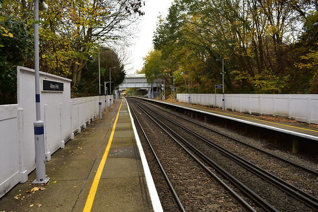
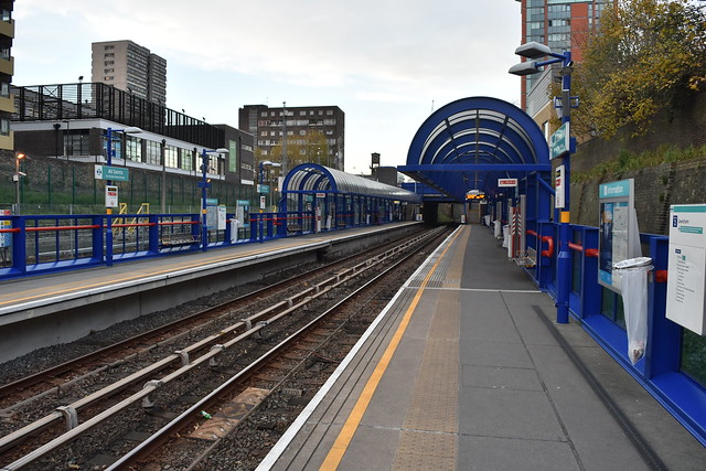
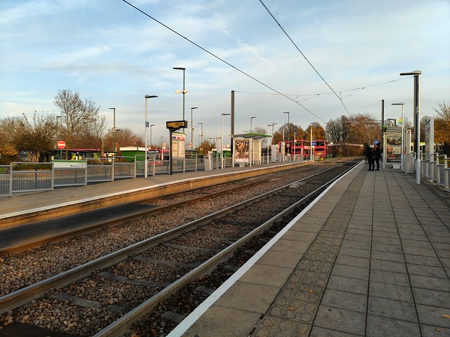
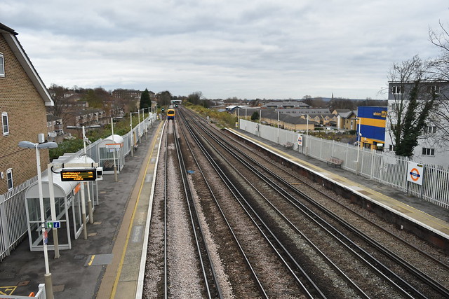
Alperton lies on the Piccadilly line, on the northbound branch from Acton Town towards Rayners Lane and Uxbridge. Originally opened by the District Railway (as the first electrified surface line on the Underground network), the station transferred to the present-day Piccadilly line in 1932. In preparation for this, the original timber framed structure was demolished, and in its place was built a Charles Holden-designed brick construction, topped with a flat roof (the design was repeated all along the Piccadilly line; some are now Grade listed). Inspired by European Modernist archictecture of the time, the design was groundbreaking, although Holden described them as merely "brick boxes with lids". The platforms have concrete canopies at the southern end, supported by concrete pillars; this does make the platforms look a bit bleak and grey, particularly on this overcast morning. Outside the station, one's eye is immediately caught by the intriguingly named Clay Oven Banqueting Suites; the building also houses a cash & carry and a gym. The railway bridge dominates to the right, just past which lies Alperton Bus Garage.

Alperton Underground Station platforms 
 
Leaving Alperton behind, I take the Piccadilly back down to Earl's Court, where I change for a District line train to Victoria. From here it's a Southern service to East Croydon, then a tram westwards to...

Ampere Way (AMP)
Station opened: 30th May 2000
Railway opened: 22nd October 1855 (by the Wimbledon & Croydon Railway, on the trackbed of the Surrey Iron Railway)
Served by: Tramlink
Zone: Tram
Passenger entries/exits (2016): 0.615 million
Stations served:
  • Beckenham Junction (6tph)
  • Elmers End (6tph)
  • Wimbledon (12tph)
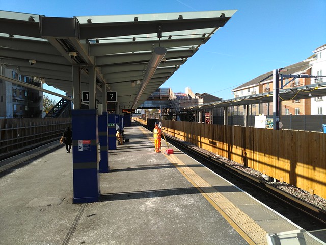
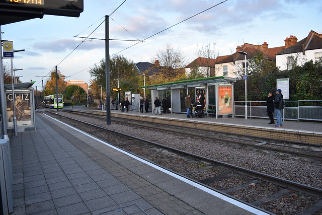
Ampere Way is situated on the Wimbledon branch of the Tramlink network. Opened in 2000 along with the rest of the tram network, the route had been part of the West Croydon to Wimbledon railway; dwindling passenger numbers saw the line closed in 1997 in preparation for conversion to the current use. The station itself is a standard Tramlink station, with two low platforms, a shelter on each and some Oyster readers.

(A slight aside here: most tram stops look pretty much the same if we're honest, so subsequent entries regarding them may well be shorter and/or refer back to previous entries!)

Ampere Way serves a range of shops in cavernous warehouse-esque settings, probably the most well-known of which is IKEA. Built on the site of the Croydon B power station, the iconic chimneys have become a notable landmark.

Ampere Way tram stop 
 
I decide against visiting IKEA for a meatball-based lunch, and instead catch a tram to West Croydon, where I change for an Overground train to...

Anerley (ANZ)
Station opened: 5th June 1839 (as Anerley Bridge)
Railway opened: 5th June 1839 (by the London & Croydon Railway)
Served by: London Overground and Southern
Zone: 4
Passenger entries/exits (2016/17): 0.973 million
Stations served:
  • Coulsdon Town (2tph)
  • Highbury & Islington (4tph)
  • London Bridge (2tph)
  • West Croydon (4tph)
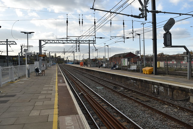
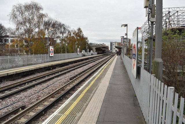
Anerley is located on what is now the East London Line of the London Overground, between New Cross Gate and West Croydon. Opened in 1839, the name is reputed to come from a local landowner on whose land the station was built; asked what landmark the station should be named for, he is said to have replied, "Mine is the annerley hoose.". The station has a layout typical of others on this section; two platforms (linked by a footbridge) on the outside of 4 tracks, the 2 middle lines being fast lines. In past times there was a grand station building on platform 1, but nowadays a small brick structure suffices, replete with ticket office and waiting room. The station has entrances on both sides; from platform 1, one will find a row of sloped terraced housing on Ridsdale Road, while the other side brings you out to the literally named Anerley Station Road. Here lies a large Wickes, and the station bus stop, under whose shelter a lone person waits for the 249 or 432.


Anerley Railway Station 
 
I head back over the footbridge to platform 1 and catch an Overground service to Canada Water, where I change for a Jubilee line train to London Bridge, changing again for a Northern line service to...

Angel (AGL)
Station opened:17th November 1901
Railway opened: 17th November 1901 (by the City & South London Railway)
Served by: London Underground Northern line
Zone: 1
Passenger entries/exits (2016/17): 19.2 million
Stations served:
  • Edgware (9tph)
  • High Barnet (9tph)
  • Morden (18tph)
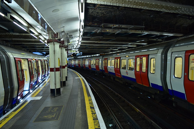
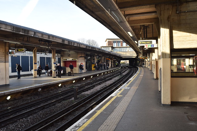
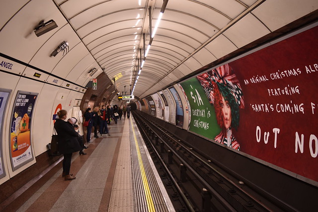
Angel can be found on the Bank branch of the Northern line. Opened in 1901, it was originally the northern terminus of the City and South London Railway's line from Clapham Common via London Bridge and Bank. An extension to Euston was opened in 1907, and the tunnels were enlarged in the early 1920s. In the 1990s the station was rebuilt, as its cramped central platform was unsuitable for the amount of people using the station. A new tunnel was bored for the northbound line, and the southbound platform was rebuilt to to the size of the original northbound tunnel, taking it from one of the narrowest platforms on the network to one of the widest.

As well as a wide platform, Angel is also home to the longest escalators on the London Underground network, at 60m long. They are one of two sets in the station; the distance from the rebuilt entrance to the platforms required two pairs to transport passengers from surface to train. Ascending the escalators brings me out into a low ticket hall, replete with florist. Stepping outside, I'm met with 3 stalls; Subterranean Flowers, Angel Fruit Cabin and Tout de Suite (providing the slightly strange combination of coffee and dry cleaning) cater for the steady tide of pedestrains hurrying past, although not many seem to stop. A multitude of vehicles rumble past on the main road; some may be making a very long journey, for this is the fledgling A1, stretching all the way to Edinburgh.


Angel Underground station 
 
I leave the flowers and the A1 behind, and head back down the longest escalator to the wide southbound platform. From here I take the Northern line to Moorgate, change for a Circle line train to Liverpool Street (very lazy I know), before taking a Greater Anglia service to Tottenham Hale. Here I wait for a bus to my next station, a bus that takes so long to arrive that I'm unable to board when it does turn up due to the sheer amount of other people also wanting it. By this point I've been at Tottenham Hale for so long that the reason for catching a bus is now moot, as there's a train to where I want to go. I head back to the train station, and catch another Greater Anglia service to...

Angel Road (AGR)
Station opened: 15th September 1840 (as Edmonton)
Railway opened: 15th September 1840 (by the Northern and Eastern Railway)
Served by: Greater Anglia
Zone: 4
Passenger entries/exits (2016/17): 0.034 million
Stations served:

  • Bishop's Stortford (8 trains a day)
  • Hertford East (3tpd)
  • Liverpool Street (1tpd)
  • Stratford (10tpd)
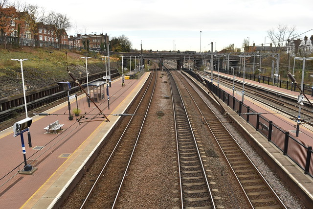
Angel Road is a railway station on the Lea Valley Lines out of Liverpool Street/Stratford, lying between Northumberland Park and Ponders End. As you may have gathered from the frequencies noted in the stations served, Angel Road is not the busiest station in the world; in fact far from it. According to the ORR's 2016/17 station usage figures, Angel Road is the least used National Rail station in London, and honestly, it's not hard to see why. One has to wonder whether the low usage begets the low frequency of service or vice versa, but nevertheless the crux of the matter is that Angel Road just isn't really near anything that would justify large amounts of people using it. The surrounding area is comprised mostly of light industry; a large Tesco is 5 minutes walk down the road, as is IKEA Tottenham (Angel Road is in fact the closest station to the IKEA; I shouldn't think many people go there instead of Northumberland Road!). For nearby residents the Overground line between Liverpool Street and Enfield/Cheshunt provides a much better service, particularly given the fact that Angel Road is only served during peak hours; there are no trains at the station between 09:52 and 16:52, and after 19:52, and no trains at all on weekends or bank holidays. Even when the station was opened it was over half a mile away from the then village of Edmonton; not exactly a convenient transport option.

The station itself is bookended by two roaring flyovers, the northerly one of which provides the sole point of access to the station, down a twisting flight of stairs and along a narrow footpath to the non-London bound platform. The platforms are linked by a footbridge, and the London-bound platform even has a shelter (surprisingly sheltering someone while I was there). Unsurprisingly there is no ticket machine, only an ancient looking PERTIS machine by the entrance, where you can also find a old CRT display providing train service info; info that may soon be obsolete. 600m down the line a new station, called Meridian Water, is opening to better serve a new housing development, and the Department for Transport has begun a consultation on closing Angel Road for good; I can't imagine an enormous amount of people will be protesting the decision.

Angel Road railway station 
 
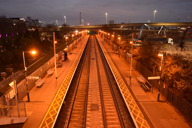
I walk up the footpath and climb the stairs to emerge on the flyover, serenaded by the noise of traffic and the scrap metal works next door. There's no other word for it; on this dark, cold December evening Angel Road is bleak. Looking around it's hard to imagine how this lonely station could ever have been popular, serving nothing or no-one of any great note. I leave the station behind and head on down to the Tesco, from where incredibly there is a direct bus to Waterloo. Yes, of course I took it all the way there...

Monday 20 August 2018

Alphabetical London: Albany Park - All Saints

I'm undertaking a project to visit all 598 Underground, Overground, National Rail, DLR, Tram and Cable Car stations in Greater London in alphabetical order. Here's Day 2.

It's a chilly start on the 24th November as I head out to my first destination of today's trip, via Waterloo and Waterloo East. Breakfast taken on a near-empty Southeastern class 376, I change at Hither Green for a train to...

Albany Park (AYP)
Station opened: 7th March 1935
Railway opened: 1st September 1866 (by the South Eastern Railway)
Served by: Southeastern
Zone: 5
Passenger entries/exits (2016/17): 0.967 million
Stations served:
  • Cannon Street (4tph, 2 via Woolwich Arsenal)
  • Charing Cross (2tph)
  • Gravesend (2tph)
Albany Park lies on the Dartford Loop Line, which runs from Dartford to Hither Green. It was the last station opened on the line, built at the behest of the housing development company who were constructing large estates in the then farmland for inner London families to move out to. The two platforms lie in a cutting which, with the help of the copious tree cover, helps to give the station an almost countryside feel, particularly as I have the station to myself at this moment. Albany Park is the least used of the 8 stations on the line, the only one indeed to see less than 1 million passengers pass through in 2016/17. Exiting the station brings me out at the end of a cul-de-sac, lined on either side with various retails outlets including Smarty Pants Dry Cleaners, 3 hairdressers and a carpet shop. Straight ahead is The Albany pub, which, according to their website, hosts weekly meetings of the Bexley Ukelele Club. The station building is a squat brick structure, with a low ceilinged ticket office; it almost feels like it's trying to be unobtrusive, not getting in the way. I pass back through the ticket office, and await the next London-bound service; the few minutes give me time to admire the artwork on both platforms, produced by students of Bexleyheath Academy in partnership with Southeastern.

Albany Park from London end

Eventually the train to Cannon Street rolls in; I jump aboard and ride it all the way to the end, where I change for a Circle line train to...

Aldgate (ALD)
Station opened: 18th November 1876
Railway opened: 18th November 1876 (by the Metropolitan Railway)
Served by: London Underground Circle and Metropolitan lines
Zone: 1
Passenger entries/exits (2017): 8.85 million
Stations served:
  • Amersham (2tph)
  • Chesham (2tph)
  • Uxbridge (8tph)
  • 6tph in each direction on the Circle Line
 Aldgate is served by the Circle and Metropolitan Underground lines, and is the terminus of the latter. The station was one of the last to be opened on what we now know as the Circle, being a terminus at the end of an extension from Liverpool Street for 6 years before the railway was extended through to (what is now) Tower Hill in 1882. The station's 4 platforms lie under a low brick ceiling, criss-crossed by riveted metal bars and lit by jarringly modern fluorescent strips. The effect is rather claustrophobic, particularly when combined with the narrow platform width, and it's somewhat of a relief to ascend the stairs into the airier mezzanine level. Here you'll find a destination board with each platform's next train listed, and a small horticultural display underneath (which, alas, was not looking its best in late November). It's also much easier to appreciate the original train shed from this vantage point, and to look across to St Botolph Street which runs along the back of the shed. Stepping through the ticket hall, I emerge on Aldgate High Street, the lesser known prequel to the A11. Traffic, both vehicular and pedestrian, rushes past Peter's Cafe and Aldgate Travel Goods (Stock Clearance ongoing), while to the west, the bulbous figure of 20 Fenchurch Street rises above the surrounding buildings. The station frontage is clad in (well, what once was) white marble faience, with lettering across the top proclaiming the station name, as well as name-checking the Metropolitan Railway in initialled form. Black Sheep Coffee occupy one of the retail units; the other lies empty behind opaque windows. Sandwiched as it is between two bland office blocks, the station feels low and cramped even on the outside, matching the platforms.

Aldgate platforms

I leave Aldgate behind, and take a short walk up the road, to...

Aldgate East (ALE)
Station opened: 6th October 1884  (resited 31st October 1938)
Railway opened: 1st October 1884 (by the District Railway)
Served by: London Underground District and Hammersmith & City lines
Zone: 1
Passenger entries/exits (2017): 14.00 million
Stations served:
  • Barking (9tph)
  • Ealing Broadway (6tph)
  • Hammersmith (6tph)
  • Richmond (6tph)
  • Upminster (12tph)
  • Wimbledon (3tph)
 Aldgate East lies on the District and Hammersmith & City lines, the first station (or last, depending on your perspective) to be served by both. Opened in 1884, it was resited in 1938 to allow for the expansion of the triangular junction to the east. The station has a rather underwhelming street presence, having no significant surface buildings; only 4 entrances, two at the western end of the station and two at the eastern end (one on each side of Whitechapel Road, under which the platforms lie). I arrive at the northwestern (so as to speak) entrance, which is built into another office block and clad in some sort of faux brownish marble. Across the road lies the other western entrance, a standalone structure in the shadow of Aldgate Tower; architecturally it is, quite frankly, unremarkable. I head through the ticket hall and down to platform level, where I find a much brighter, airier space than at Aldgate. This is mostly due to the resiting; in order to make the new station completely subsurface, the track was lowered by around 7 feet. The platforms are tiled in light cream with blue borders at regular intervals, which helps with the light, welcoming feel of the station. Above, more riveted metalwork criss-crosses the roof above the tracks; dotted here and there are hooks, from which chains suspended the track during the aforementioned lowering (the trackbed was dug out from underneath the track, which was supported on wooden trestles until excavation was complete; the track was then lowered into place over the course of a single night).

Aldgate East platforms

A Hammersmith & City line train rolls in, and I board for a short hop to Moorgate, where I change to take one of my favourite train services in London; the Northern City Line. Formerly a London Underground line, ownership was transferred to British Rail in 1976, and the subterranean stations, from Moorgate to Drayton Park, all retain Network Southeast branding. Quite marvellous. From Moorgate I take a Great Northern train, alighting at...

Alexandra Palace (AAP)
Station opened: 1st May 1859 (as Wood Green)
Railway opened: 7th August 1850 (by the Great Northern Railway)
Served by: Great Northern
Zone: 3
Passenger entries/exits (2016/17): 1.622 million
Stations served:
  • Hertford North (1tph)
  • Moorgate (6tph)
  • Stevenage (1tph)
  • Watton-at-Stone (1tph)
  • Welwyn Garden City (3tph)
 Alexandra Palace is situated on the Great Northern Route, the southern part of the East Coast Main Line. Opened several years after the railway, the station is a junction station, with the Hertford Loop diverging from the mainline just to the north. The station has 4 platforms straddling 6 lines, 2 of which are fast lines. The platforms are surfaced with a rather nice pinkish brick, which is a stark contrast to the ugly footbridge that links all the platforms with the ticket office, and provides pedestrian access from one side of the railway to the other. I take the footbridge to said ticket office, and emerge out onto the imaginatively named Station Road. A steady stream of traffic flows past The Starting Gate pub (located at the original start point of the Alexandra Palace Racecourse, hence the name). Coming back from a newsagents on St Michael's Terrace gives me the opportunity to get a good look at the station building. Constructed out of light brick, the windows and doors are surmounted by terracotta arches, and the building is topped off with a dark slate roof. There used to be station buildings on the western side of the railway as well, but these are no longer in use.

Alexandra Palace station from footbridge

I decide I can't really visit the station without also visiting its namesake, so I cross the footbridge and slog up the hill towards that famous broadcasting tower. I recall from a previous visit there is a cafe by the boating lake, and I have a lovely spot of lunch watching the ducks and a couple of hardy joggers. Refuelled, I climb up to the palace itself; last time I was here it was very foggy and the excellent view was rather obscured, but today the panorama southwards is crystal clear. I spend a few minutes admiring the vista, then head back down the hill. Onto a Great Northern service, changing at Highbury & Islington for an Overground service to Stratford, then a DLR down to...

All Saints (ALS)
Station opened: 31st August 1987
Railway opened: 31st August 1987 (by the Docklands Light Railway, on the trackbed of the former North London Railway)
Served by: Docklands Light Railway
Zone: 2
Passenger entries/exits (2016): 2.160 million
Stations served: 
  • Canary Wharf (6tph)
  • Stratford (6tph)
All Saints is located on the DLR branch between Poplar and Stratford. It was built on the site of the former North London Railway's Poplar station (not to be confused with the former London & Blackwall Railway's Poplar station; neither are to be confused with the current DLR station!). As one of the original stations on the DLR network, All Saints retains much of its 1987 character, such as the classic blue-ribbed canopies and bright red handrails. I take the stairs up to the entrance to the station; here you'll find a couple of ticket machines, and some Oyster readers, underneath a rather ugly canopy. Outside the station runs the busy A13, otherwise known as East India Dock Road. Immediately my eye is drawn to a large mural daubed on the side of a block of flats across the road, depicting a derpy yet starry-eyed chihuahua. Not quite to my taste, but impressive nonetheless. Having crossed the road to get a better look at the front of the station, I return to the southbound platform; looking up my next destination, I deem it too far to get to before darkness falls, and so end my day at All Saints.

All Saints platforms

I may not have visted very many stations today, but to be honest, this project isn't about rushing around everywhere in the shortest time possible; it's about enjoying the travel, and the exploration of nearly every corner of London. In that respect, I'm doing well so far. Until next time...

Thursday 18 January 2018

Alphabetical London: Abbey Road - Addiscombe

On 17th November, I embarked on the stupidest project I've ever thought of; to visit all 598 Greater London rail, light rail and cable car stations in alphabetical order. Great things often start small, and so it was the case here, as I began this caper with...

Abbey Road (ABR)
Station opened: 31st August 2011
Railway opened: 1846 (part of the Eastern Counties & Thames Junction Railway)
Served by: Docklands Light Railway
Zone: 2/3
Passenger entries/exits (2016/17): 1.204 million
Stations served (frequency):
  • Stratford International (6 trains per hour)
  • Woolwich Arsenal (6 trains per hour)
Abbey Road lies on the section of DLR between Canning Town and Stratford International, originally built in 1846 by the Eastern Counties & Thames Junction Railway, and later part of the North London Line between Richmond and North Woolwich. Opened in 2011, it has a small residential catchment area to the east, and light industry to the west, with the Stratford Market Jubilee Line Depot immediately adjoining the station site. Upon exiting the station you are deposited on a bridge that gives the station its name (which itself takes its name from the former nearby Stratford Langthorne Abbey, once the 5th largest abbey in the country until Henry VIII started dissolving them). It's not the most inspiring view it has to be said, faced with construction hoardings on the other side of the road and a row of houses to the left, with a distant sighting of the gleaming rooftops of Canary Wharf over warehouses to the south. The station itself is a standard 2 platform affair, quiet late on a Friday morning. Of particular note is a poster filled with puns on Beatles songs advising confused tourists that this isn't *that* Abbey Road (that one's in St John's Wood).

Abbey Road DLR station 
 
Trains to Woolwich Arsenal are every 10 minutes, so I don't have to wait too long to get on with the first proper journey of the project, down to Woolwich Arsenal itself (won't be here properly for quite some time), then onto an almost empty Southeastern National Rail service to arrive at...

Abbey Wood (ABW)
Station opened: 30th July 1849
Railway opened: 30th July 1849 (part of the South Eastern Railway)
Served by: National Rail (Southeastern) (& Crossrail in 2018)
Zone: 4
Passenger entries/exits (2016/17): 2.989 million
Stations served:
  • Barnehurst (2tph)
  • Dartford(2tph)
  • Gillingham (2tph)
  • London Cannon Street (6tph via Woolwich Arsenal, 2tph via Sidcup)
  • London Charing Cross (2tph)
Abbey Wood lies on the section of the North Kent Line between Dartford and Charlton, built and opened in 1849. The station is currently a building site, as the southeastern terminus of Crossrail prepares for services to Reading from 2019 (fingers crossed). One section of the refurbishment that is already operational is the new ticket hall, a bright, open space with wood beams lining the roof and very new ticket machines in the corner. The area outside the station is currently covered with more building works, so there's not much to see other than blue hoardings and orange hi-viz everywhere; the station opens onto a wide road bridge, from the other side of which there's a decent view over some of residential southeast London. It also allows for a wide view of the new sweeping station roof and gives an idea of the extent of the refurb of the station. One quirk is that, in preparation for Crossrail services, management of the station has been transferred to MTR, which creates the strange situation of a station being managed by one company but having all its trains managed by another.

Abbey Wood railway station
 
One of the "rules" for this project is not planning my journeys between stations in advance, and it's as a result of this that I end up "missing" my first train, as the Charing Cross service departs just a minute or two before I arrive back at the station from the massive Sainsbury's just down the road. So it is that I have to wait for a Southeastern service to Cannon Street instead, where I change to take the District line all the way to Gunnersbury, where I change again for an Overground train to...

Acton Central (ACC)
Station opened: 1st August 1853 (as Acton; renamed Acton Central 1st November 1925)
Railway opened: 1853 (as the North and South Western Junction Railway)
Served by: London Overground
Zone: 3
Passenger entries/exits (2016/17): 1.932 million
Stations served:
  • Richmond (4tph)
  • Stratford (4tph)
Acton Central today lies on the stretch of Overground between Richmond and Willesden Junction, opened by the North and South Western Junction Railway in 1853 to link between the London and North Western Railway at Willesden and the London and South Western Railway at Kew (hence the name of the company). Acton Central station itself is a two-platform affair, with flower planters dotting the platforms at the southern ends and adding some colour to what is otherwise a very blandly coloured station. Some traces remain of the station's history, including ornate ironwork at the top of the platform canopy supports, but London Overground have very much stamped their orange brand everywhere. Immediately upon taking a picture a very deep voiced man comes on over the tannoy, but I can't make out whether he's telling me off or announcing next weekend's engineering works. Exiting the station brings me to the bustling Churchfield Road, with a row of shops and cafes to the west, and a level crossing immediately to the east (which surely causes quite some congestion in the evening; a steady stream of traffic passes by even in the early afternoon). The area definitely feels a lot busier than my first two locations, both in and out of the station.

Acton Central station 

There are a number of stations with Acton in the name; Acton Central is the first of 3 that start with Acton, and the next would be a right pain in the arse to get public transport to, so I decide to take a 10 minute walk, along residential streets filled with properties which regularly sell for over a million pounds. Goldsmith, Grafton, Messaline and Emanuel combine to bring me to...

Acton Main Line (AML)
Station opened: 1st February 1868 (as Acton; renamed Acton Main Line 1st November 1949)
Railway opened: 4th June 1838 (by the Great Western Railway)
Served by: Great Western Railway (& Crossrail from 2019)
Zone: 3
Passenger entries/exits (2016/17): 0.239 million
Stations served:
  • Paddington (2tph)
  • Hayes & Harlington (2tph)
Acton Main Line is the first station out of Paddington on the Great Western Main Line, opened in 1838 by the Great Western Railway. Despite its position, it actually gets a surprisingly sparse service; 2 trains an hour between Paddington and Hayes & Harlington. The station has three platforms, although at the moment only 2 are in use, and no real station building to speak of. The entrance is on a road bridge (are you spotting a theme here?), with a flight of stairs down to either platform, and ticket machines between. Outside the station is Harry's Bar Cafe, not looking particularly busy post-Friday lunchtime, and a few other shops past either end of the bridge. I finish taking pictures, and look to the information board by the top of the steps to see when my next train was; turns out I was in for a 25 minute wait. This gave me plenty of time to have a wander up platform 3 (some benches, a tiny shelter and not much else), have some lunch, realise I'd forgotten to tap in, go back to the top of the stairs, come back again, finish my lunch and watch someone on the opposite platform walk all the way to the end and back again.

Acton Main Line railway station

Eventually the 13:51 came into view, and I boarded for the short hop to Ealing Broadway, where I changed for a District line service down to...

Acton Town (ACT)
Station opened: 1st July 1879 (as Mill Hill Park; renamed Acton Town 1st March 1910)
Railway opened: 1st July 1879 (by the District Railway)
Served by: London Underground District & Piccadilly lines
Zone: 3
Passenger entries/exits (2016): 6.27 million
Stations served:
  • Upminster (6tph)
  • Ealing Broadway (6tph)
  • Cockfosters (~17tph)
  • Rayners Lane (6tph [2tph continue to Uxbridge])
  • Heathrow Terminal 4 (6tph)
  • Heathrow Terminal 5 (6tph)
Acton Town, my first Underground station! The station is an important junction between the District and Piccadilly lines, and was opened by the District Railway in 1879 on an extension from Turnham Green to Ealing Broadway. There are 4 platforms, with 1 & 4 generally used by District line trains and 2 & 3 by Piccadilly line trains. Concrete features heavily in the design of the station, with the canopies and supports, and the bridge between platforms all cast in varying shades of unappealing grey. Approaching the ticket hall I pass the station book swap, or at least an empty shelf advertising a book swap. The ticket hall itself is high-ceilinged, with tall windows in the front wall, allowing some of the afternoon light through. The station is a Charles Holden design, or redesign I should say; the station was rebuilt twice, firstly in 1910, and then in 1932 in preparation for the arrival of the Piccadilly line (so maybe I should really say reredesign). Outside the station a steady stream of traffic rumbles over the bridge; on the other side one can see the Transport Museum depot to the north of the station, along with the tangle of tracks that take trains north or west to Ealing. One other feature Acton Town can boast is a toilet, something I'm very grateful for (although I do have to pay for the privilege).

Acton Town underground station

Conveniences taken advantage of, I catch a Piccadilly service to South Kensington, change for a District service to Victoria, change again for a Southern service down to East Croydon then a final change onto a tram to reach...

Addington Village (ADV)
Station opened: 10th May 2000
Railway opened: 10th May 2000 (by Croydon Tramlink)
Served by: Tramlink
Zone: Tram
Passenger entries/exits (2014!): 1.35 million
Stations served:
  • New Addington (8tph)
  • Wimbledon (8tph)
Addington Village, also known as Addington Interchange, lies on the New Addington branch of the Tramlink system, built in the late 90s and opened in 2000. The station is a standard tram station, with two raised platforms and not a whole lot else; a couple of ticket machines, some information displays and a few bins. Outside the station the main feature is a large bus station (hence Addington Interchange), from which you can catch services to Bromley, Thornton Heath, Purley or even Caterham. The only other notable building I can see is a petrol station on the other side of the roundabout, hidden by trees; the actual Addington Village is a little way down the road.

Addington Village tram stop

While uploading a picture of the station to Twitter, I nearly fail to spot the tram pulling in to take me on to my next destination, leading to an embarrassing jog up the platform; I wave an apologetic hand to the driver as I board. The tram takes me to Sandilands, where I change for a tram towards Beckenham Junction to alight at...

Addiscombe (ADS)
Station opened: 23rd May 2000
Railway opened: 19th August 1885 (by the Woodside and South Croydon Joint Railway)
Served by: Tramlink
Zone: Tram
Passenger entries/exits (2014): 1.18 million
Stations served: 
  • Beckenham Junction (6tph)
  • Elmers End (8tph)
  • West Croydon (8tph)
  • Wimbledon (4tph)
Addiscombe is situated on the Beckenham Junction/Elmers End branch of the Tramlink system, and was opened on the site of the old Bingham Road Halt of the Woodside and South Croydon Joint Railway, a railway that the constructors of Tramlink found rather useful when it came to building the network. The station is again a standard Tramlink station (see above [I'm sorry, architecturally Tramlink stations are very boring and homogenous]), bounded at either end by a road; Bingham Road at the south and Lower Addiscombe Road at the north. The original railway crossed both of these roads by bridge, but now level crossings halt traffic every few minutes, which must be vaguely inconvenient for any drivers round here. Outside the station is the main shopping area of Addiscombe, including a cafe imaginatively named "The Tram Stop". Otherwise it's your usual mix of estate agents, charity shops, banks and fast food outlets, busy with families and schoolchildren free for the day.

Addiscombe tram stop

My next destination is a bit of a pain to get to from here, and it's getting dark anyway, so Addiscombe ends up being my finishing point for the first day of this project. Importantly it's been fun, and interesting, so I have high hopes going forward. 7 down, 591 to go...