
It's the 12th April, and I'm standing at
Petts Wood station, ready to set off on my second section of the London LOOP, from Petts Wood to West Wickham Common. This section is section 3 of TfL's designated division of the walk, and is supposed to be around 9 miles long. Before I start, I have a confession to make: this is actually not the first time I've tried this walk. Around a week and a half previous, I made the (quite literally) ill-fated decision to try this the day after suffering from a hideous cold-like ailment. Unsurprisingly I didn't make it particularly far before deciding it was best for me and the walk to give up and leave it for another day. A shame, seeing as the weather on that day was gloriously sunny, whereas today's walk starts under dull grey clouds. I nip into a nearby Morrisons to grab some provisions (not doing this being another mistake I made first time round), then head off up Queensway, passing the
crest of Petts Wood (no I didn't know they had one either). Technically the LOOP actually restarts at the eastern entrance to the Jubilee Country Park, reached via the delightfully named Tent Peg Lane, upon which I'm assaulted by a rather unfriendly dog. Luckily I emerge from the encounter unscathed, and pass into the park to properly start section 3 of the London LOOP.
 Jubilee Country Park
 was bought by Bromley Council in 1977 to celebrate, as the name suggests, Queen Elizabeth II's Silver Jubilee, and was opened to the public as a park in 1981. My route took me along the southern edge of the park, with a
wide vista of grassland and trees to the north. Several butterflies weaved between the trees as the path curved southward, running alongside a primary school for the last bit before bringing me to the rather less tranquil Southborough Road (receiving attention from another excitable, although less aggressive dog along the way). A trudge down some rather unexciting suburban streets follows, but at the end of Faringdon Avenue the path leads into Crofton Woods, home to a section of the Kyd Brook, tributary to the River Ravensbourne via the River Quaggy.
Through the trees the path wound, showing recent evidence of horse riding and cycling in its rather uneven state. Passing out of the wood takes me alongside one of the branches of the aforementioned Kyd Brook until I'm brought out to the A232 (Crofton Road). A rather uninspiring section follows, down a
narrow alleyway then along more residential streets, but soon I'm directed off into Darrick Wood, which slopes uphill, then bends left along some playing fields, before bringing me out to a
rather magnificent view, over the London/Kent border. I head down the field, past a playground and onto a path that leads to a busy main road (the A21), which I scamper across through a gap in the traffic. Past some garages and up a
Prime Ministerially-themed set of residential streets, to emerge in the village of Farnborough.

Farnborough (derived from Fearnbiorginga, meaning "village among the ferns on the hill") has existed since 862 AD, when records show Ethelbert gave away 950 acres at Farnborough. By the 13th century a manor existed here held by Simon de Montfort. The village grew up on the road from London to Hastings, and became a coaching stop in the 1600s. Being a coaching stop means a fair few pubs have existed and do exist in the village, including the
Change of Horses; on one day during the 1970s the pub went through 3 names in a day, opening as the New Inn, changing to the Golden Nuggett (to suit the theme of that year's St Giles Fair), then renaming to its current name in the evening! Trying to leave Farnborough I misread my directions and the map, and erroneously headed west back towards the A2. I didn't mind as it meant I passed a few more local landmarks, including
The Woodman pub; upon taking a picture the landlord appeared from inside and asked why I was taking said picture (rest assured nothing unfriendly, in fact the complete opposite). After carrying on in the wrong direction for another couple of minutes, I finally gave up and got my phone out, and got myself back on track. My route out of Farnborough took me past
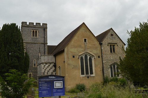
St Giles the Abbot Church, where a wedding party was assembling, then through the graveyard and into an
expansive field. I kept left, hugging the edge of the woods before plunging into them as the hill continued to take me downwards. I soon reached a country lane, and crossed over to enter High Elms Country Park.
 High Elms Country Park
 started life as a farmhouse belonging to the Brazier family; the Lubbock family bought the estate in 1808. A manor house was built in 1842 by John Lubbock III, but its most famous resident is probably his son,
John Lubbock IV, a scientist and social reformer who became Baron Avebury in 1900. The estate was sold to Orpington District Council in 1930, and subsequently used as a training centre for nurses from King's College Hospital. In 1967 the estate passed to the London Borough of Bromley, who designated it protected Green Belt space. I investigate the Green Roof Cafe as a potential place for lunch, but
decide against it. Instead I climb a short hill, passing the
Eton Fives Court, the best preserved remainder of the estate. After pausing for a bite to eat, I continue up the hill to come out at the
site of the manor house, now a grassy space with indications of where the house used to be. I head out the other side, down a
tree lined path, and find myself in a car park. This is the first point on the LOOP where I get slightly lost, with a lack of signposts and the directions in my guide vague. Eventually I find my way out to High Elms Road, where I cross over to a narrow footpath just off the road. Passing High Elms Farm on the left (I'll give you one guess as to why it's nicknamed '
Clockhouse'), I turn right and head away from the road, past
a golf course and into some woods, which bring me down to North End Lane, opposite North End Farm and a bus stop; despite only having 12 services a day, I was (un)lucky enough to arrive at the same time as an R8 tried to squeeze its way down this narrow, unpavemented lane. Fortunately I managed to avoid being squashed, and continued down one of the more
amusingly named roads of this walk.

The LOOP takes me round the edge of some more fields, before dumping me
on Farthing Lane, which twists and turns past horses and pylons to feed into Shire Lane; for the first time in a while I have to wait cross the
road into, yep you guessed it, another field. The LOOP stays close to the road here, but I'm looking the other way, towards a
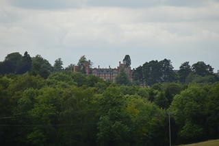
distant house
on the horizon. Further investigation when I get home reveals it to be
Holwood House, former residence of 19th century Prime Minister William Pitt the Younger and site of an important decision (more on that in a moment). I follow the edge of the field, which skirts round Holwood Farm, and
begin my ascent of what turns out to be a hideously steep hill. I arrive at the top, sweaty and out of breath, grateful for the appearance of a bench. Pausing here gives me the chance to admire a great view, and to take a look at the Wilberforce Oak; for this is the site of the aforementioned decision. It was here, in 1788, that William Wilberforce resolved to campaign for the abolition of the slave trade after a conversation with Pitt the Younger; it took another 20 years before the Slave Trade Act was passed into law. I rest here for a few minutes, the occasional plane buzzing overhead (
Biggin Hill Airport lies less than a mile and a half to the south), before deciding it was time to press on.

The LOOP carries on through the woods, now descending gently in contrast with the steep rise earlier, eventually coming to the A223 Westerham Road, where I cross over and enter
Keston Common. This area was initially inhabited by Iron Age settlers in around 200 BC, who constructed
earthworks to help with the threat of invasion. These earthworks are still visible today, although eroding badly. The path takes me across the earthworks and through a car park, then down to a
small pool of water. This doesn't look much, but it's reputed that Julius Caesar set up a camp here after being led to the spring by a raven; this then explains the name of the river that has its source here: the
River Ravensbourne. The fledgling river runs down a brick lined culvert into Keston Ponds, a favourite spot for anglers and walkers alike, and one of the prettiest points of this walk. The LOOP cuts between the two ponds, then takes back into more woods, before bringing me out by another primary school onto Lakes Road, which in turn leads to
Keston Village Green, a spot I recognise from a visit some years previously.

I'm on the home strait now, as the route pretty much parallels a tree lined road. I'm hemmed in by houses and fences on my left, although occasionally these drop away to reveal a v
iew to the southwest, towards (though I don't know it at the time) the vague location of my next LOOP walk. However, this walk has one last surprise in store before the end, which is another set of
Iron Age earthworks. These later became part of a medieval field system, then possibly an artificial rabbit warren in the 17th century. The view southwest opens up again one last time, before I head quite steeply downhill, past
a tree planted for West Wickham's centenary celebration, ending up on the busy A232. Typically the nearest bus stop is rather infrequently served, and so my walk is slightly prolonged as I carry on to a stop that has better services. A few minutes wait gave me the chance to catch my breath and rest my legs from what had been a long, but undoubtedly pleasant walk. As the bus arrived to whisk me back to Bromley, I already had half an eye on the next one...
A selection of photos here:

 Monday 12th June finds me at the bottom of West Wickham Common, ready to set off on section 3 of my London LOOP walk. This one is marked to take me through Addington, Whyteleafe & Hamsey Green on the way to Coulsdon. It's not the best start to a walk I have to admit, immediately directed off down an alleyway that soon brings me out to a residential street. However, it's not long before the first greenery of the day appears, in the shape of Coney Hall Recreation Ground. It's here that I stumble across an unexpected early highlight; a small stone obelisk marking the passage of the Greenwich Meridian through the park. I pause for a moment, doing what tourists from around the world queue to photograph 7 and a half miles north, then continue past a nursery and across a road into the entrance of Wickham Court School; Wickham Court itself was the ancestral home of the Boleyn family, and was where Henry VIII proposed to Anne Boleyn, mother of Elizabeth I. My route takes me past the entrance gate and into the churchyard of St John's (who have their own blog). A tantalising view through the trees tempts me to the western edge of the churchyard, but alas, there's not much to see, and the presence of a pair of curious workmen nearby prompts my departure.
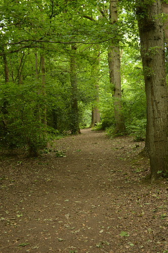 The walk takes me down a hill into a field of horses, a few of which break off from their grass-munching to eye me suspiciously as I pass by. Crossing a busy road at the bottom of the field takes me into Sparrows Den, a location that holds some treasured memories for me as the location of a pitch and putt course my late grandad took me and my brother to whenever we stayed with him. I cut diagonally across several rugby pitches (owned by Old Beccehamians R.F.C.) to reach a wood, which marks my entrance into Spring Park, a City of London owned common since 1926 (although not actually registered as a common today). The path cuts upwards then banks left, to take me along the southern edge of Cheyne Wood. An information board along the way relates the story of the superb Ancient Order of Froth Blowers, a charitable organisation that helped fund a children's heart hospital in the area. The LOOP continues through the trees for some distance, crossing stream beds and at one point, the boundary between the boroughs of Bromley and Croydon, which also marks the transition into Threehalfpenny Wood. Eventually the path leads out onto an area of open grassland, Shirley Heath, where an unexpected vista to the north reveals the skyscrapers of the City and Canary Wharf in the distance. It's not the last time I'll spot them on this walk.
 The route dives back into trees, taking me through Kennel Wood past groups of homebound schoolchildren, before emerging onto Shirley Church Road. I follow this road for just over half a mile, passing Shirley Road Recreation Ground (the open nature of which reveals the Crystal Palace Transmitter in the distance), before turning left past Shirley High School and up a tarmacked path to Sandpits Road. It's at the end of this road that a limitation of the LOOP asserts itself; being effectively a linked-up collection of paths, when it comes to having to cross busy roads there's not much option other than waiting for a brief gap in the traffic and dashing across. Luckily I don't have to wait too long, and am soon on the move again, heading towards Addington Hills. Having been to the viewpoint before, I was prepared for a somewhat steep climb, but still found myself heavily out of breath after a brutally vertiginous ascent. The view makes it all worth it however, with a wide panorama stretching out before me; from Croydon in the west, round past the twin transmitters and the City, to Canary Wharf and Lewisham in the east. I rest for a few minutes, having a bite to eat, before deciding it's time to carry on.
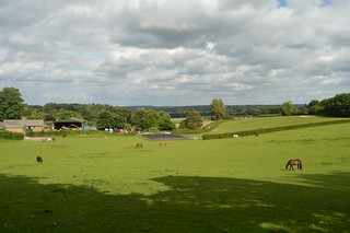 Leaving the viewpoint, I head southwards, past a signpost that tells me I'm now 21 1/2 miles from Erith, and 25 1/4 miles from Kingston Bridge. Passing a rather ominous pentagram drawn in the earth, I'm led southwest down a dip filled with fragrant pine trees, with the path becoming darker as the trees close in on the way out. Passing Coombe Lane tram stop on the right, I follow the tram tracks for a short while, before turning off to enter another small grove of trees, which slope downwards and bring me to the manor house of Heathfield. A former farm turned Georgian manor estate, replete with ornamental gardens and stable, nowadays the house is used as an ambiguously named "training centre", while the grounds are the base for the Croydon Ecology Centre. Skirting round a pond, I head up some steps and back out to a road, then stride downhill past a man performing some classic car maintenance, before plunging into the latest area of woodland, this being Bramley Bank. The woodland is managed by the London Wildlife Trust, and apparently contains the largest woodland pond in Croydon! Another view across the fields presents itself, before I have to negotiate a tricky section overgrown with stinging nettles. Luckily I escape unscathed, and continue down through the trees.
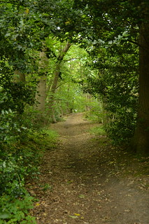 It won't surprise you to hear that almost immediately upon emerging from Bramley Bank I'm back into another wood, this one Littleheath Woods. The woods were bought by a combination of Croydon Council, Coulsdon & Purley Council and publicly raised money to save them from housing development, and they were dedicated as a public space in 1932. The LOOP cuts into Fallen Oak Field, where a lone man on a bench watches my progress along the bottom of the field, then diverts south into Foxearth Wood. I'm joined at this point by the Vanguard Way, another long-distance route that runs from Croydon down to Newhaven in East Sussex; I'll be paralleling this walk for the next couple of miles. I get a bit confused further on and end up taking the wrong path at a junction by a water tower, emerging from the woods much too early and in completely the wrong place. Retracing my steps I manage to take the right path at the second time of asking, and proceed down an increasingly narrow tongue of woodland to Addington Road (more precisely the boundary between the wards of Selsdon and Addington). Crossing the road I'm led up a bridleway that strikes out between backs of houses towards Selsdon Wood. It's here that I encounter my second steep ascent of the day, and by the time I reach the entrance to Selsdon Wood I'm panting heavily. Foolishly I don't have much water with me, so I make do with what I have as I rest for a moment, before continuing up into the wood.
 Selsdon Wood is officially Ancient Woodland, but small parts were used for farming in medieval times. In the early 20th century the land was broken up and started to be sold off. Local groups were concerned about the rate of development of the formerly rural Selsdon, and rallied together to purchase a 200-acre area, which was passed to the National Trust, and opened to the public in 1936. The LOOP is signposted up a hill that slopes northeastwards, through oaks and beech. Eventually the gradient levels out somewhat, meaning I can stop feeling like my lungs are about to fall out. The reason for all the hilliness is the North Downs, the chalk ridge that runs through Surrey and Kent and the foothills of which I'm now entering. Passing a lone dogwalker, I come to a narrow track, Baker Boy Lane. It may not look much, this path between wood and field, but the boundary between London and not-London runs parallel a couple of metres to the west; indeed by walking down this path I'm now marginally in Surrey. The field is soon replaced by Puplet Wood on my left, but it's not long before both woods are left behind, as the lane emerges close to the entrance to Farleigh Golf Club. I'm then directed down the side of Elm Farm, leaving the Vanguard Way behind, as I meander downwards through Mossy Hill Shaw. A grand house sits on the horizon to the north; later research reveals it to be the De Vere Selsdon Estate, seat of the Bishop of Rochester for much of the 19th century, but converted to a luxury hotel in 1925. Emerging in a field filled with waist-high wheat stalks (now back in London again), I soon come to a tarmacked road, which becomes increasingly residential, signalling my arrival at Hamsey Green and the end of part 1 of this walk. Part 2 takes in two valleys, an airfield and an unexpected astronomical feature...