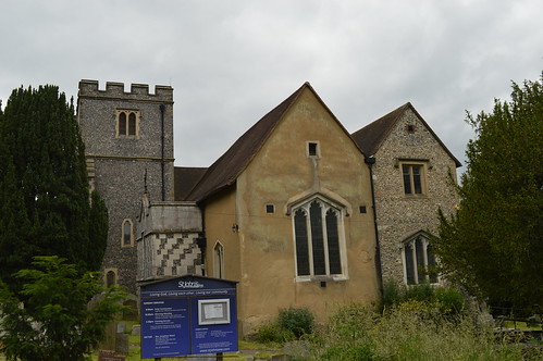
 Monday 12th June finds me at the bottom of West Wickham Common, ready to set off on section 3 of my London LOOP walk. This one is marked to take me through Addington, Whyteleafe & Hamsey Green on the way to Coulsdon. It's not the best start to a walk I have to admit, immediately directed off down an alleyway that soon brings me out to a residential street. However, it's not long before the first greenery of the day appears, in the shape of Coney Hall Recreation Ground. It's here that I stumble across an unexpected early highlight; a small stone obelisk marking the passage of the Greenwich Meridian through the park. I pause for a moment, doing what tourists from around the world queue to photograph 7 and a half miles north, then continue past a nursery and across a road into the entrance of Wickham Court School; Wickham Court itself was the ancestral home of the Boleyn family, and was where Henry VIII proposed to Anne Boleyn, mother of Elizabeth I. My route takes me past the entrance gate and into the churchyard of St John's (who have their own blog). A tantalising view through the trees tempts me to the western edge of the churchyard, but alas, there's not much to see, and the presence of a pair of curious workmen nearby prompts my departure.
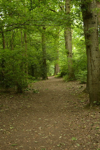 The walk takes me down a hill into a field of horses, a few of which break off from their grass-munching to eye me suspiciously as I pass by. Crossing a busy road at the bottom of the field takes me into Sparrows Den, a location that holds some treasured memories for me as the location of a pitch and putt course my late grandad took me and my brother to whenever we stayed with him. I cut diagonally across several rugby pitches (owned by Old Beccehamians R.F.C.) to reach a wood, which marks my entrance into Spring Park, a City of London owned common since 1926 (although not actually registered as a common today). The path cuts upwards then banks left, to take me along the southern edge of Cheyne Wood. An information board along the way relates the story of the superb Ancient Order of Froth Blowers, a charitable organisation that helped fund a children's heart hospital in the area. The LOOP continues through the trees for some distance, crossing stream beds and at one point, the boundary between the boroughs of Bromley and Croydon, which also marks the transition into Threehalfpenny Wood. Eventually the path leads out onto an area of open grassland, Shirley Heath, where an unexpected vista to the north reveals the skyscrapers of the City and Canary Wharf in the distance. It's not the last time I'll spot them on this walk.
 The route dives back into trees, taking me through Kennel Wood past groups of homebound schoolchildren, before emerging onto Shirley Church Road. I follow this road for just over half a mile, passing Shirley Road Recreation Ground (the open nature of which reveals the Crystal Palace Transmitter in the distance), before turning left past Shirley High School and up a tarmacked path to Sandpits Road. It's at the end of this road that a limitation of the LOOP asserts itself; being effectively a linked-up collection of paths, when it comes to having to cross busy roads there's not much option other than waiting for a brief gap in the traffic and dashing across. Luckily I don't have to wait too long, and am soon on the move again, heading towards Addington Hills. Having been to the viewpoint before, I was prepared for a somewhat steep climb, but still found myself heavily out of breath after a brutally vertiginous ascent. The view makes it all worth it however, with a wide panorama stretching out before me; from Croydon in the west, round past the twin transmitters and the City, to Canary Wharf and Lewisham in the east. I rest for a few minutes, having a bite to eat, before deciding it's time to carry on.
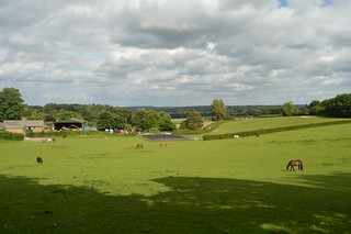 Leaving the viewpoint, I head southwards, past a signpost that tells me I'm now 21 1/2 miles from Erith, and 25 1/4 miles from Kingston Bridge. Passing a rather ominous pentagram drawn in the earth, I'm led southwest down a dip filled with fragrant pine trees, with the path becoming darker as the trees close in on the way out. Passing Coombe Lane tram stop on the right, I follow the tram tracks for a short while, before turning off to enter another small grove of trees, which slope downwards and bring me to the manor house of Heathfield. A former farm turned Georgian manor estate, replete with ornamental gardens and stable, nowadays the house is used as an ambiguously named "training centre", while the grounds are the base for the Croydon Ecology Centre. Skirting round a pond, I head up some steps and back out to a road, then stride downhill past a man performing some classic car maintenance, before plunging into the latest area of woodland, this being Bramley Bank. The woodland is managed by the London Wildlife Trust, and apparently contains the largest woodland pond in Croydon! Another view across the fields presents itself, before I have to negotiate a tricky section overgrown with stinging nettles. Luckily I escape unscathed, and continue down through the trees.
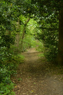 It won't surprise you to hear that almost immediately upon emerging from Bramley Bank I'm back into another wood, this one Littleheath Woods. The woods were bought by a combination of Croydon Council, Coulsdon & Purley Council and publicly raised money to save them from housing development, and they were dedicated as a public space in 1932. The LOOP cuts into Fallen Oak Field, where a lone man on a bench watches my progress along the bottom of the field, then diverts south into Foxearth Wood. I'm joined at this point by the Vanguard Way, another long-distance route that runs from Croydon down to Newhaven in East Sussex; I'll be paralleling this walk for the next couple of miles. I get a bit confused further on and end up taking the wrong path at a junction by a water tower, emerging from the woods much too early and in completely the wrong place. Retracing my steps I manage to take the right path at the second time of asking, and proceed down an increasingly narrow tongue of woodland to Addington Road (more precisely the boundary between the wards of Selsdon and Addington). Crossing the road I'm led up a bridleway that strikes out between backs of houses towards Selsdon Wood. It's here that I encounter my second steep ascent of the day, and by the time I reach the entrance to Selsdon Wood I'm panting heavily. Foolishly I don't have much water with me, so I make do with what I have as I rest for a moment, before continuing up into the wood.
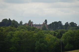 Selsdon Wood is officially Ancient Woodland, but small parts were used for farming in medieval times. In the early 20th century the land was broken up and started to be sold off. Local groups were concerned about the rate of development of the formerly rural Selsdon, and rallied together to purchase a 200-acre area, which was passed to the National Trust, and opened to the public in 1936. The LOOP is signposted up a hill that slopes northeastwards, through oaks and beech. Eventually the gradient levels out somewhat, meaning I can stop feeling like my lungs are about to fall out. The reason for all the hilliness is the North Downs, the chalk ridge that runs through Surrey and Kent and the foothills of which I'm now entering. Passing a lone dogwalker, I come to a narrow track, Baker Boy Lane. It may not look much, this path between wood and field, but the boundary between London and not-London runs parallel a couple of metres to the west; indeed by walking down this path I'm now marginally in Surrey. The field is soon replaced by Puplet Wood on my left, but it's not long before both woods are left behind, as the lane emerges close to the entrance to Farleigh Golf Club. I'm then directed down the side of Elm Farm, leaving the Vanguard Way behind, as I meander downwards through Mossy Hill Shaw. A grand house sits on the horizon to the north; later research reveals it to be the De Vere Selsdon Estate, seat of the Bishop of Rochester for much of the 19th century, but converted to a luxury hotel in 1925. Emerging in a field filled with waist-high wheat stalks (now back in London again), I soon come to a tarmacked road, which becomes increasingly residential, signalling my arrival at Hamsey Green and the end of part 1 of this walk. Part 2 takes in two valleys, an airfield and an unexpected astronomical feature...
No comments:
Post a Comment