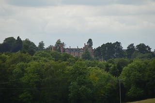
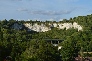
 Part 2 of this walk finds me refreshed, resupplied and ready to go in Hamsey Green. Heading out of the village (oh look, nudging back into Surrey again), I enter the rather cumbersomely named Sanderstead to Whtyeleafe Countryside Area. The area's split between three owners, two being the adjoining councils (Croydon and Tandridge) and the third being the Whitgift Foundation, a charitable organisation founded by Archbishop John Whitgift in 1596 and today providing care for the elderly, education and advice for carers. The bridleway that cuts through the area and that I'm following has been around since at least the 1570s, when a map of the time named it Broadwaye. Passing yet another dogwalker, the path leads into a small belt of trees (wouldn't you know it, I'm back in London again), within which lies an Ordnance Survey triangulation point; surprisingly the only one that lies on the LOOP. Soon I'm heading down into the spectacularly steep valley below, via Riddlesdown Road; this used to be the main coaching route towards Lewes and Brighton. Crossing a railway line, I reach the bottom, ending up on what's now the main route through the area, the A22. Consulting my guide book, my heart sinks when I see that I am indeed going to be climbing back up the other side of the valley; a third steep ascent of the day. Over the other railway line (one goes to Oxted, the other to Caterham), then up New Barn Lane (exhausting enough in itself) and into the woods again. A flight of stairs helps somewhat, but I'm still gasping when I finally reach an open field at the top (Google Earth tells me the average gradient of this short stretch was 1 in 7!). I've reached Kenley Common, one of four commons in the area grouped together under the Coulsdon Commons banner. Owned by the City of London Corporation, I've already walked across Riddlesdown (guess where Riddlesdown Road is?), and I'll meet the other two later on. Incidentally, the name's a bit of a misnomer, as none of the spaces are registered as commons today.
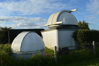 Kenley Common played a crucial role in both World Wars as a fighter plane base; along with RAF Croydon and RAF Biggin Hill, RAF Kenley was instrumental in the Battle of Britain. The airfield is still in use today, owned by the Ministry of Defence and home to 615 Volunteer Gliding Squadron; powered aircraft are currently prohibited from using the airfield. My walk takes me along the northern edge of Kenley Common, then curves southwestwards into an open field with a pair of redundant kissing gates at either end of the path. I take the opportunity to sneak a quick look at the airfield itself, then proceed up a sleepy lane and along a short stretch of pavement-less main road before diving back into the trees. Out into a field, then across a road into another field, past the Wattenden Arms pub (reputedly a favoured haunt of the airmen stationed at RAF Kenley). On the way out of this latest field, I pass a strange squat structure with a domed roof, and am quite surprised to find it's an observatory! Kenley Observatory is owned by the Croydon Astronomical Society,which celebrated its 60th anniversary last year. Construction started in 1967, and the observatory was officially opened in 1979. Unsurprisingly the observatory was closed when I went past in broad daylight, but come visit on a Saturday evening and you can take a look through their telescope. The North Downs asserts itself again as I descend down Waterhouse Lane then immediately ascend up Rydon's Lane to reach Coulsdon Common, passing the site of a former windmill on the way.
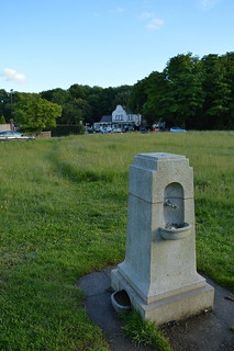 Coulsdon Common was named for the medieval manor it lay in, but unlike most of the other commons I've passed through today it was not used for agriculture, as the soil here was of too poor quality. The land was thus given over to the grazing of sheep and cattle, creating the open landscape that enabled two windmills to be erected here in the 18th century; the later of the two survived until 1924 when it was demolished. One 18th century building that's survived is The Fox pub, which was opened in 1720 and continues to quench thirsts to this day. I pass by and continue into the third of Coulsdon's Commons, Happy Valley. This area was purchased under the Green Belt Scheme of 1937, being described as "one of the most beautiful valleys in the whole neighbourhood". One of the principal reasons for its purchase was to link Coulsdon Common with Farthing Downs; after all, a belt's not much good if it doesn't join up! Initially I'm led along a broad tree-lined path, past a series of trim trail stations (I declined to make use, I though I'd done quite enough exercise already!). This path curves northwards, and brings me out to a magnificent viewpoint over the valley. Thankfully this one's not as steep as earlier, and my descent and ascent up the other side is markedly more gentle, something I'm rather grateful for at this late stage of the walk! I press on, passing a group of ramblers going in the opposite direction; rather late to be setting out into the valley I thought. I soon enter my last wood of the day, Devil's Den Wood. The name's origin is unknown; suggestions have included a pit called Devil's Den or folk legends of devil worship in the area. The wood is quite open, and I enjoy the light of the setting sun playing through the leaves as the path slopes upwards to bring me to Farthing Downs.
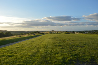 Farthing Downs is an area with some serious history behind it; archaeological evidence dates some of the earliest activity to the Neolithic Era, over 6000 years ago. Eventually a patchwork of fields dominated the landscape throughout the Iron Age, from around 700 BC into the 2nd century AD. The remnants of this farming system can be seen in some of the earth banks and ditches still visible today. By Saxon times, the land had been given over to barrows and burial mounds which, given the altitude of the Downs, would have been seen from miles round. In medieval times the land was used for the grazing of sheep and cattle, and this use continued through to the 19th century. In 1883 the City of London Corporation bought the land from Edmund Byron, but the use stayed the same until the Second World War, when Farthing Downs was requisitioned for military use. Anti-glider ditches were constructed across the landscape, and the space suffered many hits from enemy bombs and fallen aircraft. Thankfully these days rather more remains of the ancient activity than wartime damage, and the walk across this magnificent stretch of grassland is a fine way to near the end of this walk. Spotting the skyscraper cluster of Central London on the horizon for the 3rd time, I pause for a few moments to drink in the beauty of the place, illuminated by the fiery light of the setting sun, before setting off on the home strait, down some rather less pretty residential streets and up an alleyway to reach Coulsdon South station. I sink onto a bench, glad to rest my weary feet (15.2 miles up and down and up and down will tire you out!), and wait for the train to whisk me back home...
(except that didn't go quite to plan because Thameslink cancelled the train I was waiting for, so I had to get a bus to Croydon before I could catch any trains!)